Kagawa Roads of Shikoku
Asanken Kyosanryo Road
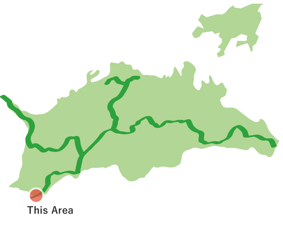
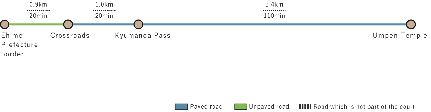
Asanken Kyosanryo Road (7.3 km)


※下記表はスクロールしてご覧ください。
 Spots to photograph
Signboard of “Kyumanda Pass”
If you wish to receive a certificate, please take a photo that includes yourself at the designated photo point for each course.
Nearby sightseeing spots
-
1
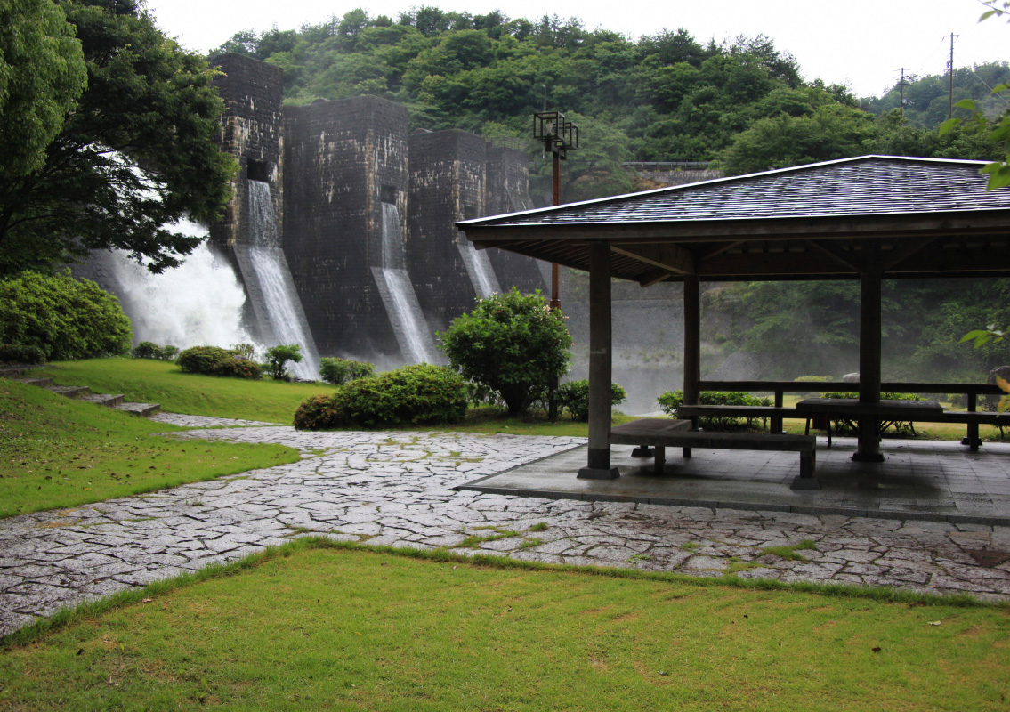 Honenike Dam
The Honenike Dam is the oldest masonry arch dam in Japan.

