Road to Umpen Temple
Road to Umpen Temple
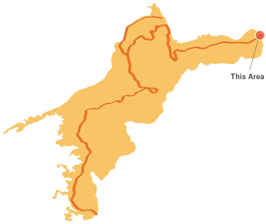
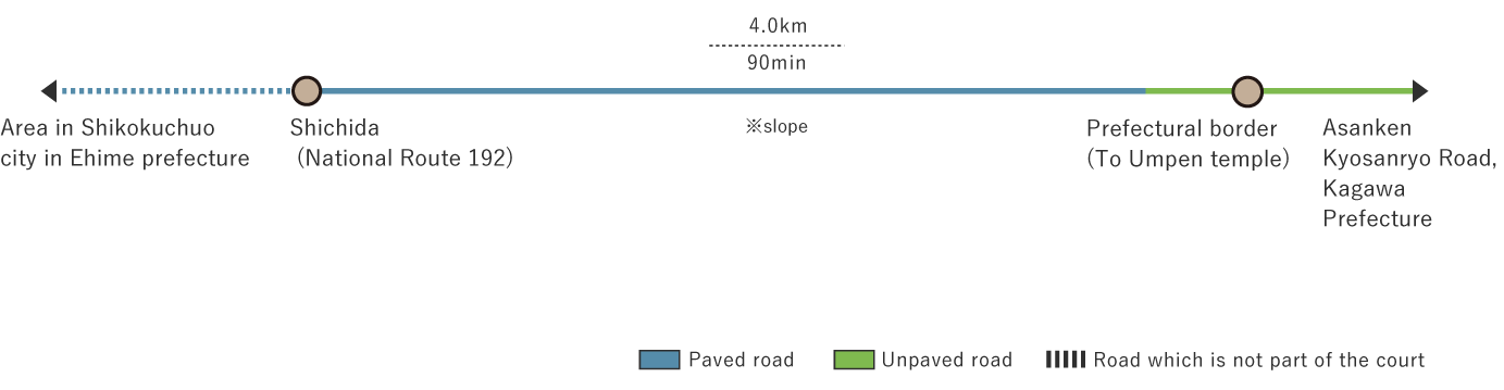
This is the easternmost course in the Shikoku-no-Michi of Ehime Prefecture.The course connects to Umpenji (Umpen Temple), the 66th of the 88 temples of Shikoku in Kagawa Prefecture.The route begins at the Kayama intersection in Kawataki Town in Shikokuchuo City on the National Route 192.From the starting point, it progresses towards the border between the three prefectures: Kagawa, Tokushima and Ehime, and ends at the prefectural border, from where it connects to "Asankenkyosanryo-no-Michi" of the Shikoku-no-Michi managed by Kagawa Prefecture.The length of "Road to Umpen Temple" on the Ehime Prefecture side is about 4 km, and the length of "Asankenkyosanryo-no-Michi" managed by Kagawa prefecture is about 7.3 km.Until about half the length of the road, it is a paved woodland path, but turns into an unpaved mountain road about 300 m short of the end point.Because the woodland path is narrow and fallen leaves may be piled up, it may be difficult to use a car bigger than a standard-sized one.The starting point is a rural landscape among the mountains, and the mountain road just before the end point is steep.You might want to use sports shoes or climbing shoes.What you might not notice while on this course is a (2,794-m long) tunnel that passes under this course. The name of the tunnel is Shinsakaime tunnel on the Tokushima Expressway.
Road to Umpen Temple(4.0km)


※下記表はスクロールしてご覧ください。
 Spots to photograph
If you wish to receive a certificate, please take a photo of yourself at the designated photo point on each course.
Nearby sightseeing spots
-
1
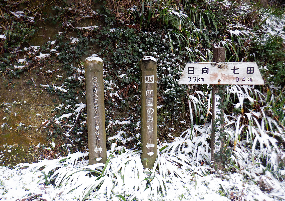
 Starting point
Shichida intersection on National Route 192.Shichida bus stop is nearby.There are guide signs and signposts.On National Route No. 192, proceed northwest as indicated by the wooden signpost.
-
2
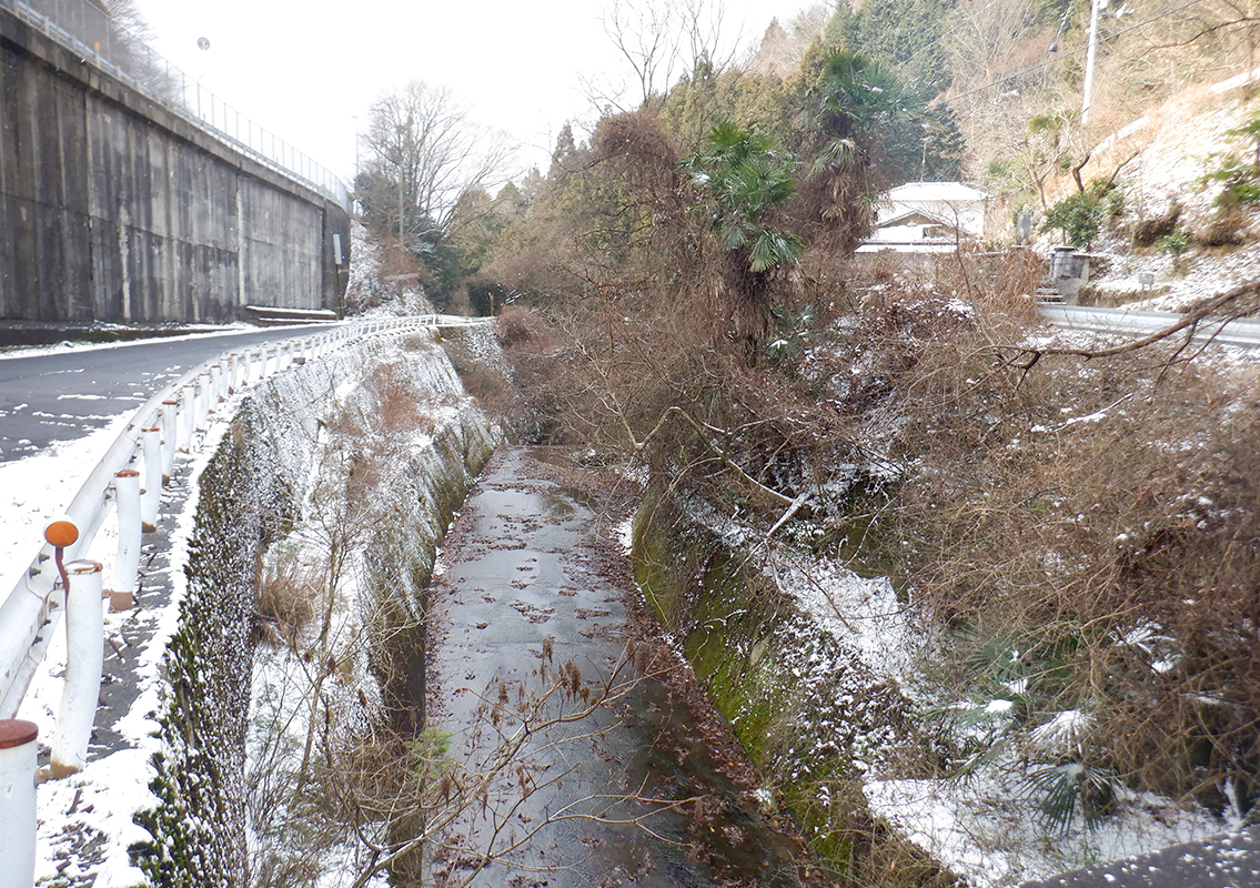 Kinsei River
A small river that flows near the starting point is called the Kinsei River, which originates near the border of Tokushima Prefecture and flows into Mishimakawanoe Port in Kawanoe Town of Shikokuchuo City.Although it looks like a mountain stream flowing down a severely steep slope around here, it changes into a wider river downstream.It is said that the name "Kawanoe Town" has originated to designate the area near the mouth of the Kinsei River.Water pollution was a problem in the 1970s, but the condition has improved and the citizens are also releasing sweetfish (Ayu) into the river.
-
3
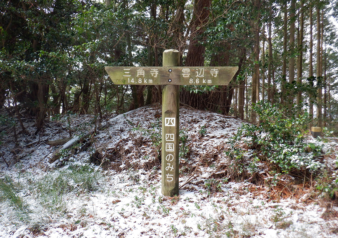
 Guidance sign
Guidance signs installed on Shikoku Roads.They are installed as landmarks.They are meant to guide the travelers walking on Shikoku-no-Michi.
-
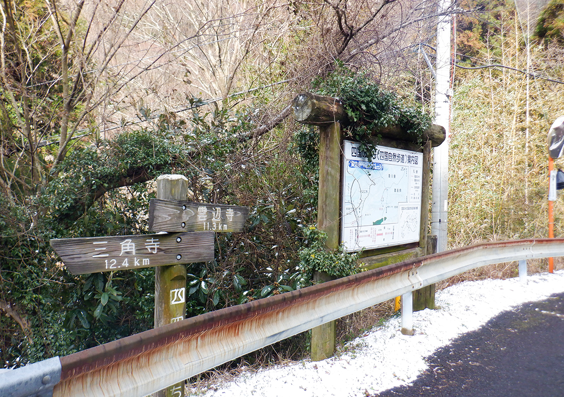
4
 Signposts and road to Umpen Temple
From this point, leave the woodland path and continue on the mountain road indicated by the sign pointing in the direction of the Umpen Temple.You arrive at the end point of Shikoku-no-Michi after a climb of 300 m on an unpaved mountain road.
-
5
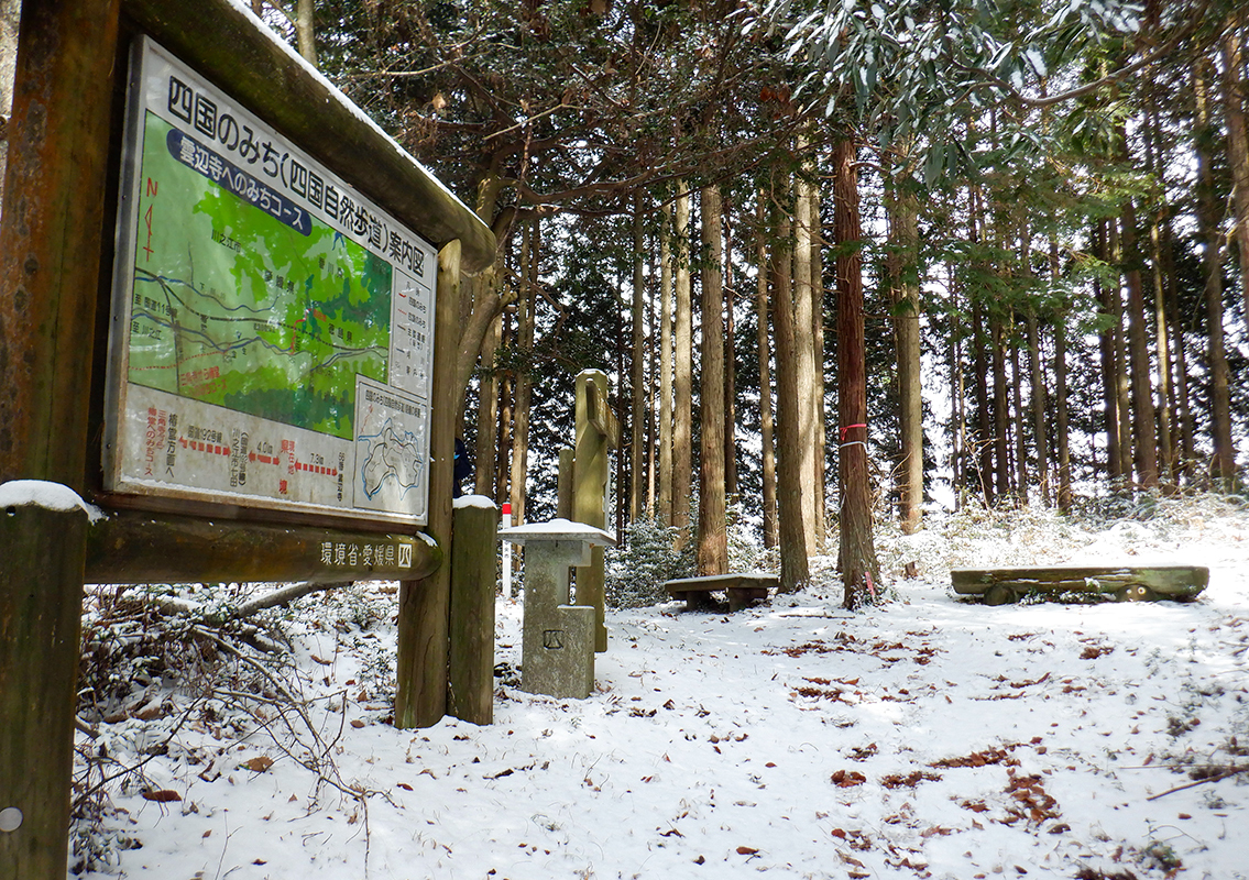 End Point
An information board, various signs and benches are installed at the end point.The information board is on the Ehime Prefecture side. From from this point, the road connects to "Asankenkyosanryo-no-Michi", a Shikoku road managed by Kagawa Prefecture, and starts to descend.This is a Shikoku road managed by Kagawa Prefecture, and it ends at a point on the border between Tokushima and Ehime Prefectures.Asankenkyosanryo-no-Michi runs along the border between Kagawa and Tokushima Prefectures, and makes it possible for travelers to leave or enter any of these two prefectures.It occupies an area near the border between the three prefectures of Kagawa, Tokushima and Ehime.This is a convenient place to visit because it is close to the border between three prefectures.To reach the three-prefecture border, follow a gentle climb from behind the guide sign at the end point.You will arrive at the destination after walking for about 10 minutes on the path having foot traces left of people who know the area or who have walked on the same path in the woods.The road follows the border between Ehime and Tokushima Prefectures, and boundary stakes indicating the prefectural border established in the National Land Survey have been installed at several meter intervals.There are installed almost along the ridge, and it may be a good idea to make a round trip by following them.
-
6
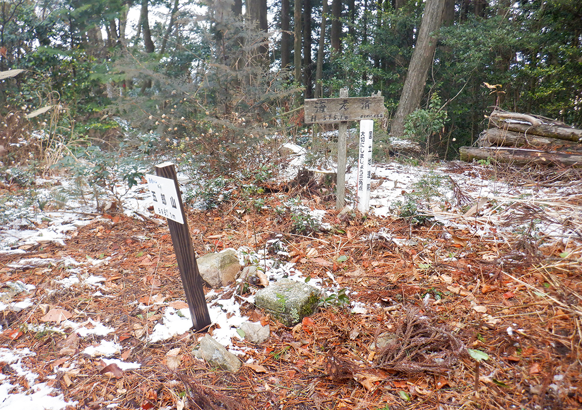 Three-Prefecture Border
The border between the three prefectures of Tokushima, Kagawa and Ehime is situated at about 10 minutes on foot from the end point of Shikoku-no-Michi.At the top, there is a triangular point established by the Geospatial Information Authority to indicate the three-point border and the prefectures that built it.Although it does not offer a great view, it is a quiet and spacious place in the woods.Stop here if you have the time and energy.

