Shikoku Karst Route No. 6
Shikoku Karst Route No. 6
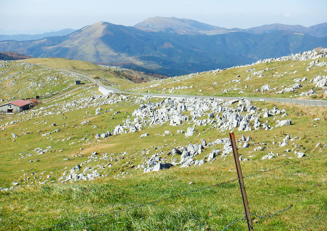
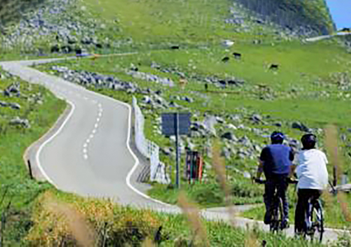
Of the six courses on the Shikoku Karst Route, this is the course from where you can enjoy the most magnificent views and expansive scenery.This course passes across the Shikoku Karst Natural Park on Ehime and Kochi Prefectural Route No. 383 which is situated on the ridgeline along the prefectural border from the starting point of Jiyoshi pass to the end point of Tenguso at the central part of the park situated across the borderline of Ehime and Kochi Prefectures.This route is also accessible by car because it is entirely paved.Being a high-altitude route, it remains closed in winter due to freezing of the road surface. Hence, before using this route, be sure to use the online or other resources to be updated about the road information.The number of people visiting by bicycle has also increased in the recent years.Shikoku Karst Rental Cycles near Mezuruso offers the popular E-BIKE (electric assist sports bicycle).Shikoku Karst, which is one of the prominent karst tablelands in Japan, is said to be one of the three major karst terrains in Japan alongside Akiyoshidai in Yamaguchi Prefecture and Hiraodai in Fukuoka Prefecture.History of Shikoku Karst: The activity of a low-latitude submarine volcano began about 300 million years ago and ended about 250 million years ago.The limestones formed through the accumulation of coral reefs around the summit of the volcano can be seen in the Shikoku Karst Natural Park.Limestones formed from the coral reefs at the summit of the volcano were carried by the moving oceanic plate. When the plate sank under the continental plate at the Nankai Trough off the Shikoku sea, some of this limestone mass was scraped off and some remained, which was later uplifted to an altitude of 1,400 m to form this structure by the virtue of orogenic movements in Shikoku's mountainous district about 2 million years ago.(Cited from Karst Learning Center. Tsuno Town, Kochi Prefecture)
Karst Learning Center:http://karusutogakusyuukan.com/index.html
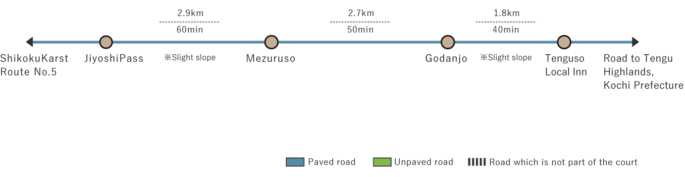
Shikoku Karst Route No. 6 (7.4 km)


※下記表はスクロールしてご覧ください。
 Spots to photograph
If you wish to receive a certificate, please take a photo of yourself at the designated photo point on each course.
Nearby sightseeing spots
-
1
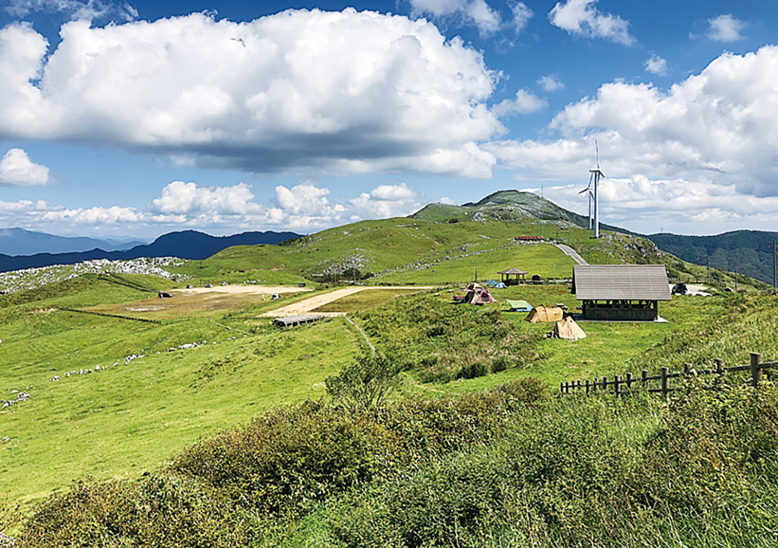
 Mezurudaira
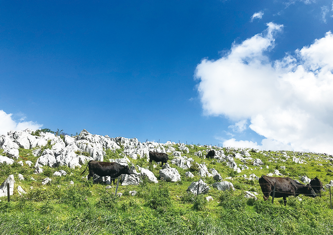
It is an area with a gentle slope located at the central part of the Shikoku Karst, one of Japan's three major karst terrains, commonly known as the "Roof of Shikoku," and is a leading dairy farming area in Ehime Prefecture.In addition to the green plains dotted with white limestone outcrops, one can enjoy the idyllic view of cows grazing from spring to autumn.It also has an open area called "Mezuruso" (open from April to November) with lodging and dining facilities, and a campsite. Mezuruso offers panoramic views of the ridgeline of the Shikoku Mountains.Mezurudaira is located near the southern tip of Kumakogen Town. On a clear day, you can even see Mt. Ishizuchi (altitude 1,982 m), the highest peak in western Japan.Mt. Ishizuchi is located on the border between Saijo City and Kumakogen Town, and forms the northern tip of the Kumakogen Town.Its straight-line distance from Mezurudaira is 36 km.That gives an idea of the size of Kumakogen Town.The view of the karst tableland in the direction of Godankogen from the Mezurudaira parking lot is magnificent.According to the testimonies of the local people, until around 1955, Mezurudaira and Godankogen were said to be totally unexplored.
-
2
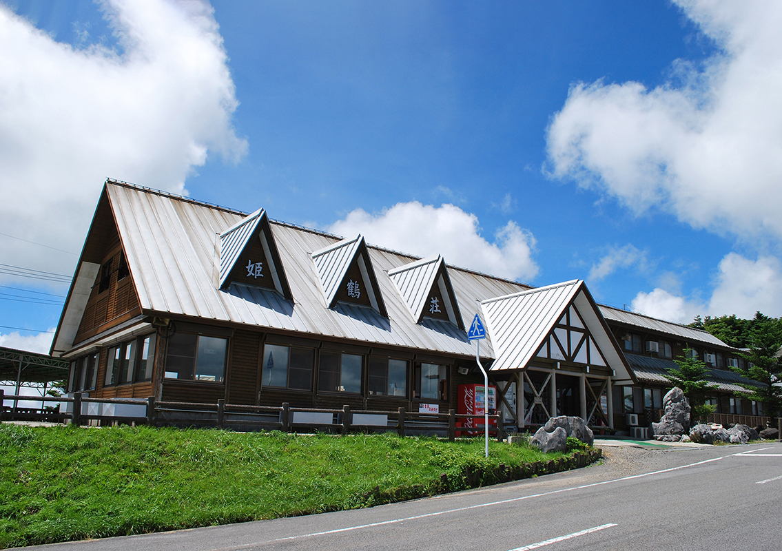 Mezuruso
This convenient accommodation facility is located approximately at the center of the Shikoku Karst on the border between Ehime and Kochi Prefectures.This facility also sells tea from Kumakogen Town, dairy sweets, smoked and Kanroni of amago. One can also enjoy rich milk-flavored soft serve ice cream in the summer.Mezuruso is also in charge of the rental Mezurudaira Cottages and campsites.The facility is closed in winter. Hence, ensure that you check the availability beforehand.
-
3
 Mezurudaira Camping Ground
Situated at an altitude of about 1,300 m is a campsite that makes you comfortable even in peak summer.It is specially recommended to the people who enjoy camping in the midst of a 360-degree panoramic view.You can also enjoy a panoramic star-studded sky.The campsite welcomes you for a comfortable stay.Just speak with the reception at the convenient accommodation facility "Mezuruso" before arrival.
Mezurudaira Camping Ground 8117 Nishidani, Kumakogen, Kamiukenagun, Ehime 791-1802
https://yanadani-skk.jp/stay/camp -
4
 Godankogen
Godankogen has the most excellent scenery among the scenic spots in Shikoku Karst. On a clear day, you can see Murotomisaki in the east and Mt. Ishizuchi in the north.People crossed Godankogen on foot when there were no roads. It is believed that this name was given to the highland because a steeply sloping road was divided into five gently sloping sections.The highest point is Godan Castle at 1,456 m.There is a sinkhole of about 6 m2 called the "Kyojin No Fumikiri (Giant's Step-Over)" in the neighboring bamboo field.Its neighborhood features sinkholes (pits formed when limestone is eroded by rainwater) of various sizes.The particularly larger sinkholes are 5-m deep and 8 m in diameter.
-
5
 Ibushi Otochi Promenade
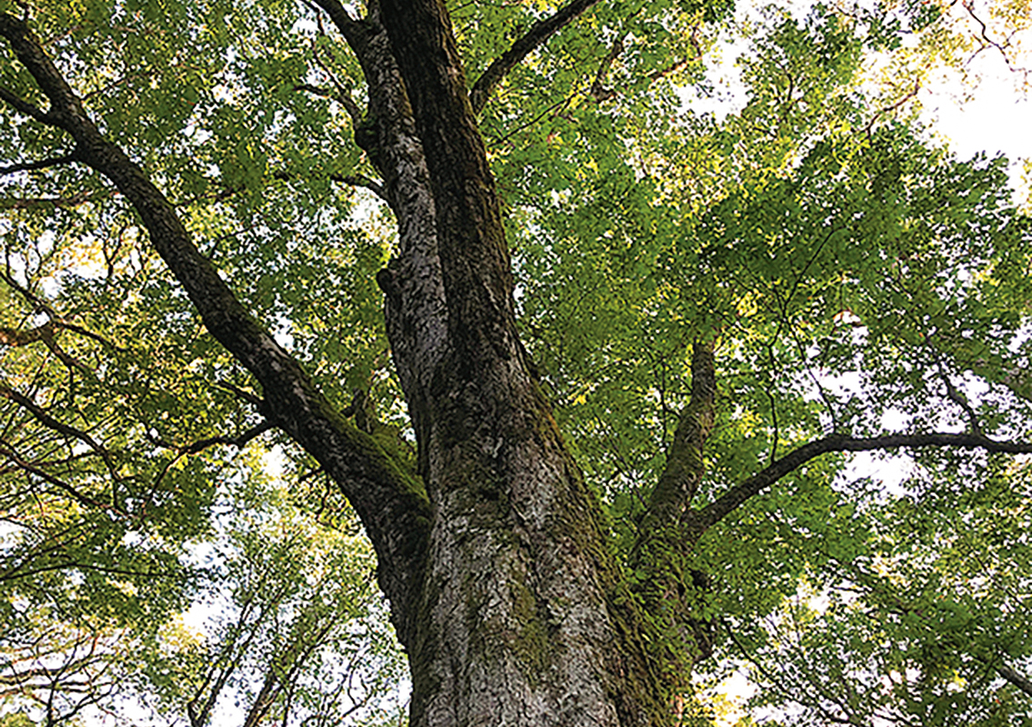
Separated from Shikoku-no-Michi, this promenade offers a combined pleasure of walking and forest bathing.Approx. 2 km one-way.There are toilets and a parking lot at the entrance.Use of simple sports shoes is recommended as the promenade is unpaved.As you walk along the promenade while gazing at the mossy and exposed limestone and fallen trees, you can find groups of various large trees zelkova and horse chestnut aged about 200 to 600 years, moss-covered rocks around them, conifers such as fir and hemlock, and broad-leaved, wide-trunk trees such as hornbeam and beech in the natural forest that spreads out under the familiar Shikoku Karst tableland, locally known as "Keyakidaira."Among them, the 600 year old Ibushi Otochi, with a height of 30 m and trunk circumference of 626 cm, has been selected as one of the "100 Forest Giants."There is a spring called "Hakua no Yusui" in the middle of the promenade.
https://www.iyokannet.jp/spot/4408
-
6
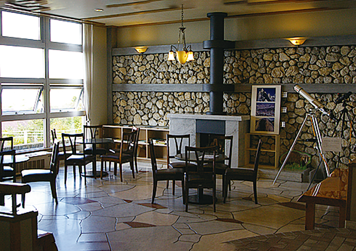 Tenguso
Tenguso is located at the foot of the Tengu Forest, the highest point in the Shikoku Karst with an altitude of 1,485 m, on the eastern end of the Shikoku Karst.Located on the border between Ehime and Kochi Prefectures, it has shops, restaurants, and accommodation facilities.Snow sports equipment is available for rent here. This is said to be one of the hubs for leisure in the Shikoku Karst area.Repair work is in progress as of January 2021.You can enjoy fresh greenery in spring, alpine plants in summer, and fall colors in autumn.The promenade is developed differently for different difficulty levels and is recommended for hiking.The Karst Learning Center and Therapy Road nearby are also recommended.The area around "Tengu-no-Mori" has natural forests of birch and red pine, and offers a different landscape from karst.From the top of the forest, one can see a series of 1000-m tall ridges in the Shikoku Mountains. On a clear day, it also offers a panoramic view of the Pacific Ocean in the distance.
-
7
 Shikoku Karst Rental Cycles
Whether you travel Shikoku-no-Michi by car or on foot, you can change your course and enjoy the Shikoku Karst to the fullest on a bicycle.You can rent the popular E-BIKE (electric assist sports bicycle) and create a memorable experience for yourself.
Reception: Karst Rental Cycle Station beside Shikoku Karst Mezuruso 8111 Nishidani, Kumakogen Town, Kamiukenagun, Ehime 791-1802 Open from beginning of April to beginning of November *May be unavailable depending on the weather.Five E-BIKEs and four cross bikes have been made available as of 2020.
https://event.kuma-kanko.com

