Shikoku Karst Route No. 5
Shikoku Karst Route No. 5
Shikoku Karst Route is a course that occupies a unique position among all the Shikoku-no-Michi routes.The Shikoku-no-Michi routes are designated to circle around Shikoku. This is another route that connects Kochi and Ehime Prefectures, and passes through the Shikoku Karst situated in the mountains that line the Kochi and Ehime Prefectural border.Shikoku Karst, which is one of the prominent karst tablelands in Japan, is said to be one of the three major karst terrains in Japan alongside Akiyoshidai in Yamaguchi Prefecture and Hiraodai in Fukuoka Prefecture.The Shikoku Karst route in this prefecture is composed of six courses, out of which the Shikoku Karst Route No. 5 starts in Komatsu in Nomura Town of Seiyo City, winds along the Shikoku Karst Nature Park located on the Ehime and Kochi Prefectural Route 383 that passes along the Ehime (Yusuhara Town) and Kochi (Kumakogen Town) Prefectural border, and ends in Jiyoshi pass.This route is also accessible by car because most of it is paved. However, special caution is necessary at the merging and dividing points because this is a single-lane road.Being a high-altitude route, it remains closed in winter due to freezing of the road surface. Hence, before using this route, be sure to use the online or other resources to be updated about the road information.
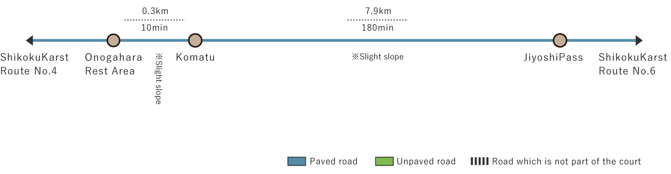
Shikoku Karst Route No. 5 (7.9 km)


※下記表はスクロールしてご覧ください。
 Spots to photograph
If you wish to receive a certificate, please take a photo of yourself at the designated photo point on each course.
Nearby sightseeing spots
-
1
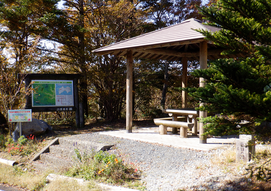 Onogahara Rest Area
Informatory signs and rest areas are available.Positioned at the end of Shikoku Karst Route No. 4, the place has been provided with toilets and ice-cream parlors that sell ice-creams made from raw milk.It also serves as a rest area for drivers.
-
2
 Onogahara
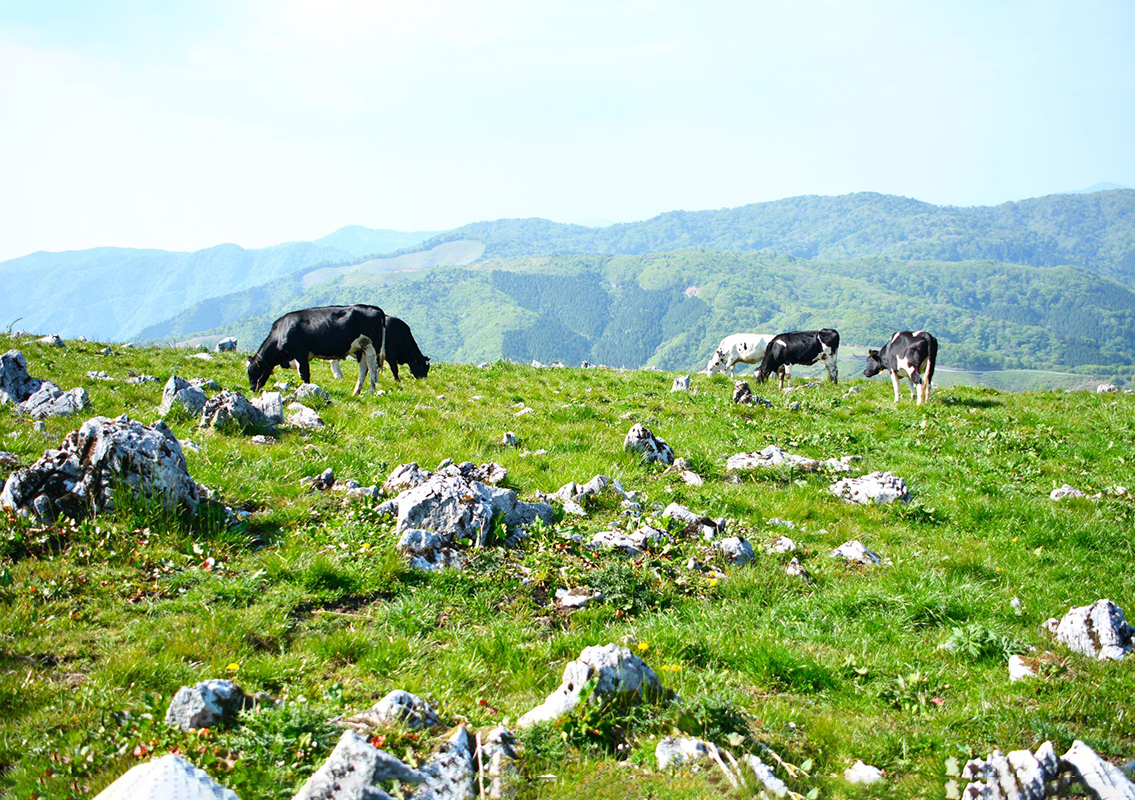
Onogahara is a highland situated to the west of the Shikoku Karst Natural Park along the border between Ehime and Kochi Prefectures.The limestone plateau, stretching over an area of 740 ha and at an altitude of more than 1,000 m above the sea level, is famous for depressions called "sinkholes" peculiar to the karst topography, and oddly shaped limestone outcrops protruding from the grasslands.Its development began when 15 members of production increase groups came here in 1946, and continued through 1950, when 30 families of first-generation settling farmers moved here.This area offers a scenery of cattle barns dotted throughout the green pastures.It is also believed to have been an artillery maneuvering ground and a grazing land for warhorses.The area is also home to private houses, cattle barns, silos and coffee houses.Delicious dairy products such as soft serve ice cream and cheesecake are very popular.
-
3
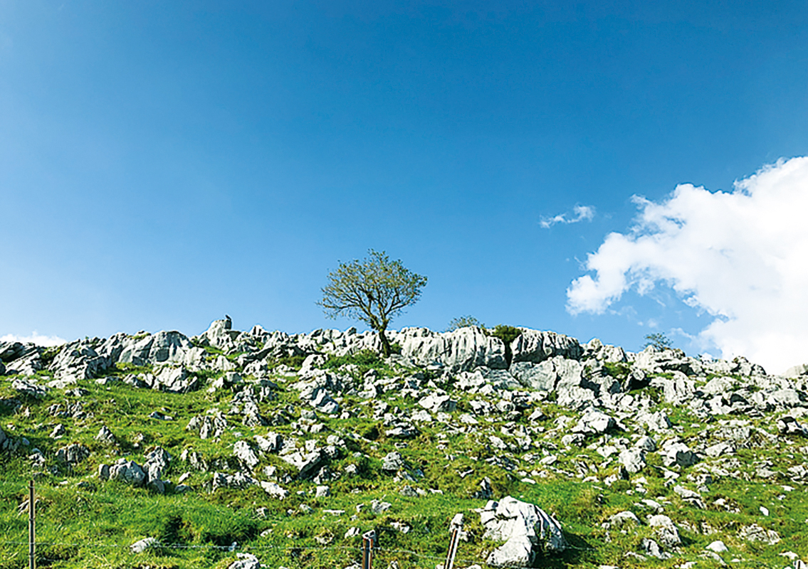 Onogahara Karst Topography
The topography peculiar to limestone terrains carved by rainwater and underground water is called karst topography.The rain falling on the tableland does not form a river but seeps underground through the crevices in the limestone.Repeated seepage over the years dissolves the limestone in the area of seepage to form a bowl-shaped depression.This depression is called a sinkhole.When two or more sinkholes coalesce, they form an uvale, and many such uvale make up a large terrain called polje.The tombstone-like rocks that remain after erosion are called Karren, and the fields where several such rocks are placed is called Karrenfeld.The limestone strata at Onogahara are made of sedimentary rocks formed about 200 million to several hundred thousand years ago, and contain fossils of creatures such as fusulinidae, corals, and snails.This plateau is believed to have been a seabed long ago.
-
4
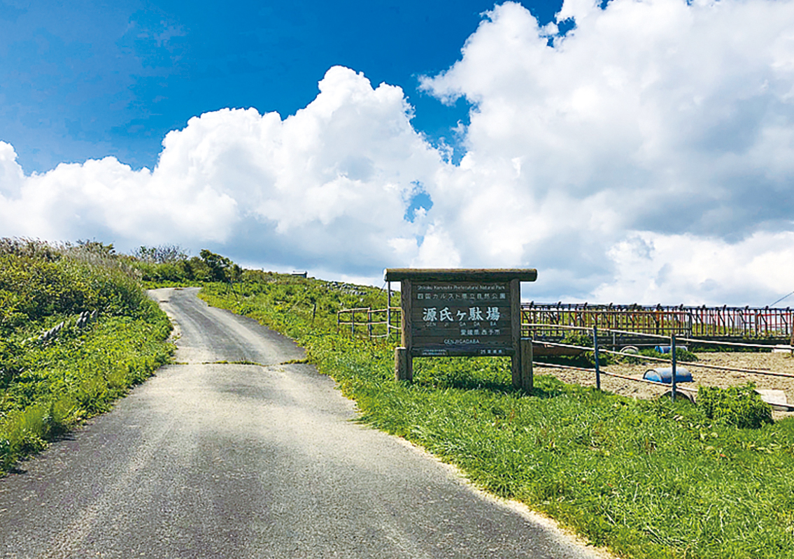 Genjigadaba
The place with the highest altitude above the mean sea level in the Onogahara area of Shikoku Karst is Genjigadaba.The name of the place comes from the legend that the remaining members of the Heike clan, which lost the battle against Genji clan, receded as they mistook the white limestones as the white horses of Genji.The terrain that looks like a flock of sheep due to a vast expanse of limestone dissolved in rainwater is called Karrenfeld.It is a famous place with a great view.
-
5
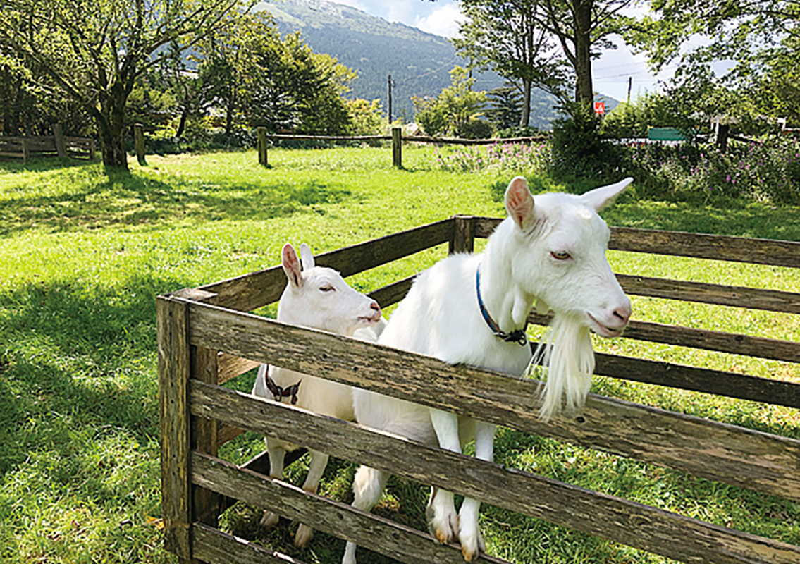 Pony Ranch
Besides ponies, from which the name is derived, one may come across the many goats, sheep and rabbits inhabiting the region.For the entrance fee and business hours, visit the following website:
https://四国カルストもみの木.com -
6
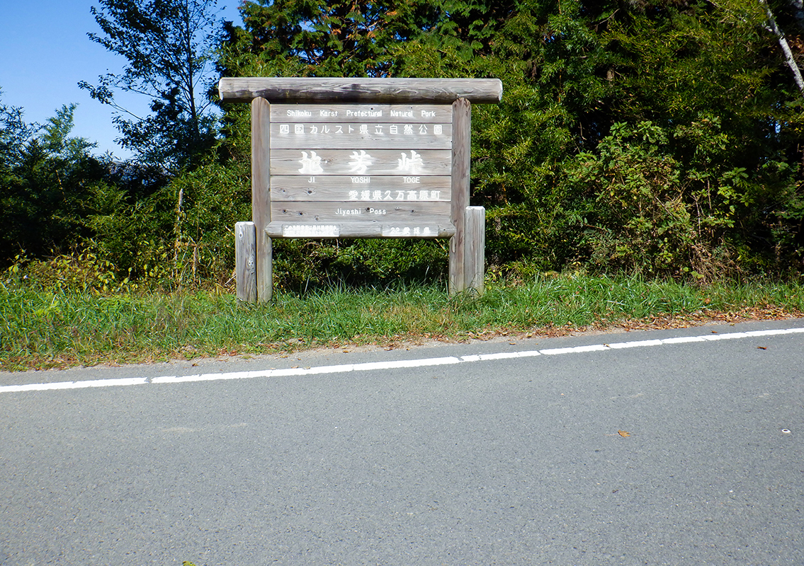 Jiyoshi Pass
Jiyoshi pass, with an altitude of 1,085 m above sea level, is located in the heart of the Shikoku Karst.Shikoku Karst is a karst terrain that stretches over 25 km from Tengu highlands in Tsuno Town in the east to Onogahara in the Nomura Town of Seiyo City on the west of Kochi Prefecture.A ridgeline spreads as gentle slopes whose altitudes range from 1,000m to 1,450m.This place is frequented by tourists from spring to autumn. According to the testimonies of the local people, until around 1955, there were roads extending along the ridge and heading towards the present-day Mezuruso in the totally unexplored areas stretching eastward from Jiyoshi pass towards Mezurudaira and Godankogen.A woodland path to Yusuhara was completed in 1964, after which a route like a pasture road was built upward (in the direction of Mezurudaira and Godankogen of Shikoku Karst) from the Jiyoshi pass.One may also get to see cows grazing here in the summer.

