Yokogura Shugen Route
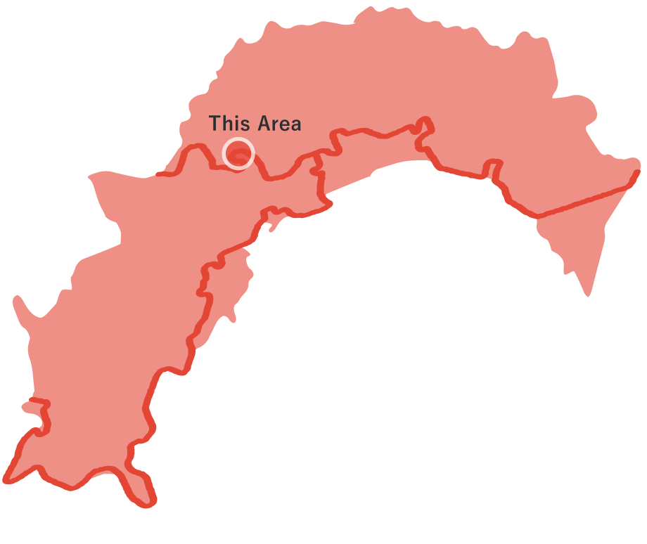
Yokogura Shugen Route
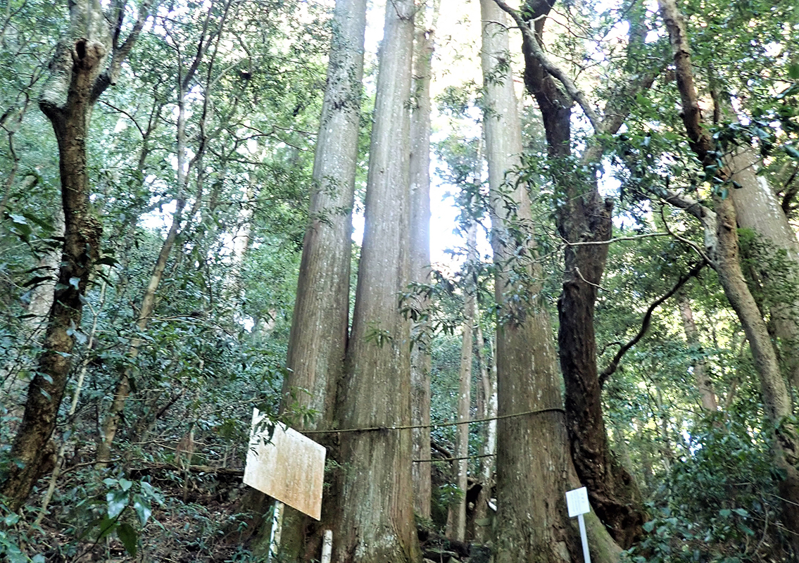
It starts at the intersection of a forest road with a huge torii gate and a prefectural road across from Miyanomae Park Campsite, one of the best-known cosmos viewing spots in Ochi-cho, and heads west on the forest road. This course leads visitors to Yokogurazan, which is home to a old-growth forest of red oak trees and a group of large cedars several hundred years old, and was also the research field of world-renowned botanist Dr. Tomitaro Makino. Since the time when Kochi Prefecture was once Tosa Province, Yokogurazan has been considered the only sacred place of religious practice of Shugendo in Kochi. Along the route, there are many places worth seeing, such as the Mari-kenaro Ryobo, the Reference site for Emperor Andoku's tomb, where he is said to be buried, and Yokoguragu Shrine, which is dedicated to Emperor Antoku, and visitors can walk around and feel the history. Around Sugihara Shrine, giant cedar trees over 600 years old line the streets, and visitors can feel the mysterious air of serenity and tranquility.
Yokogura Shugen Route(10.8km)


※下記表はスクロールしてご覧ください。
 Spots to photograph
If you wish to receive a certificate, please take a photo that includes yourself at the designated photo point for each course.
Nearby sightseeing spots
-
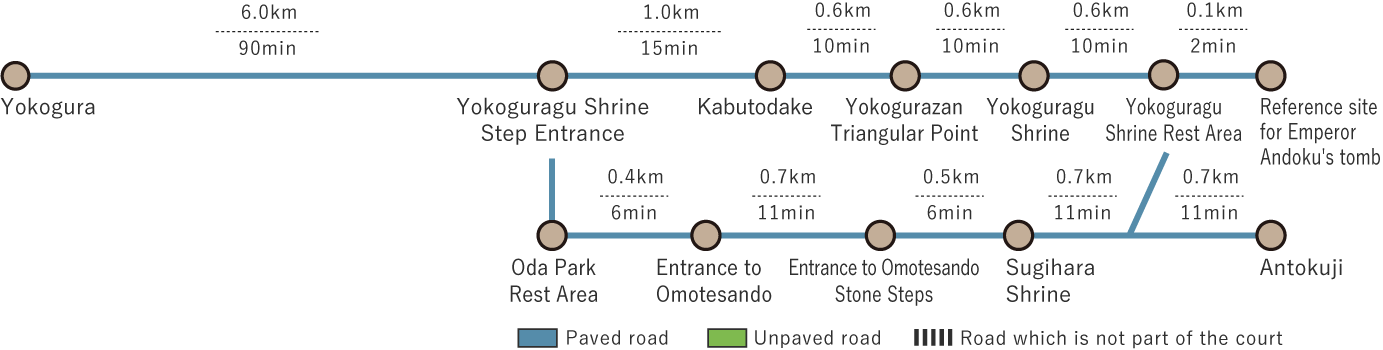
Kabutodake
This eastern peak is one of the three mountain tops, and its name comes from the fact that the ridge of the mountain has a series of cliffs like the back of a horse, which looks like a horseshoe when seen from the foot of the mountain. This rocky area, which is also known as Tosa no Ishiyama, i is suitable for able-bodied climbers and offers a thrilling view of the surrounding landscape. There is also Ishizuchi no yohaijyo, which is said to have been a place of ascetic training for mountain priests in the past.
-
1
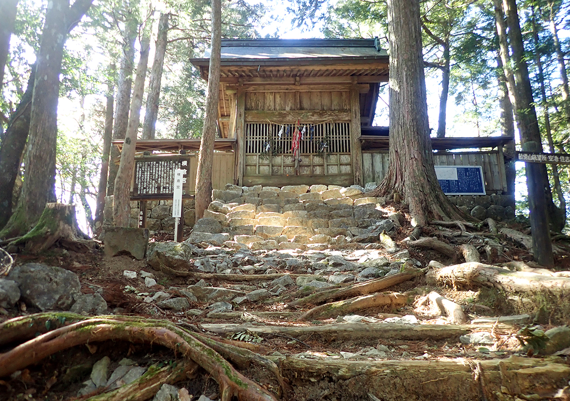 Yokoguragu Shrine
Emperor Antoku, who died at the age of 23 in the year 1200, is enshrined as the deity of the shrine, and the current shrine pavilion was reconstructed around 1897. In ancient times, “Kemari,” “Yabusame,” and the “Tachi Odori” were held as annual festivals.
-
2
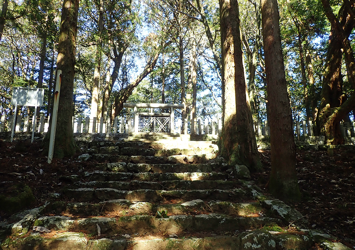 Reference site for Emperor Andoku's tomb
Located on a flat area to the northwest of Yokoguragu Shrine, it reputedly was the place where he played kemari (kick-ball) with his attendants during the emperor's visit to the palace (hence the tomb of Shioganaroryobo), who is said to have been buried here in 1200 at the age of 23. It was designated as a reference site in 1926 and is the only place in the prefecture under the jurisdiction of the Imperial Household Agency where a mausoleum guard is stationed.
-
3
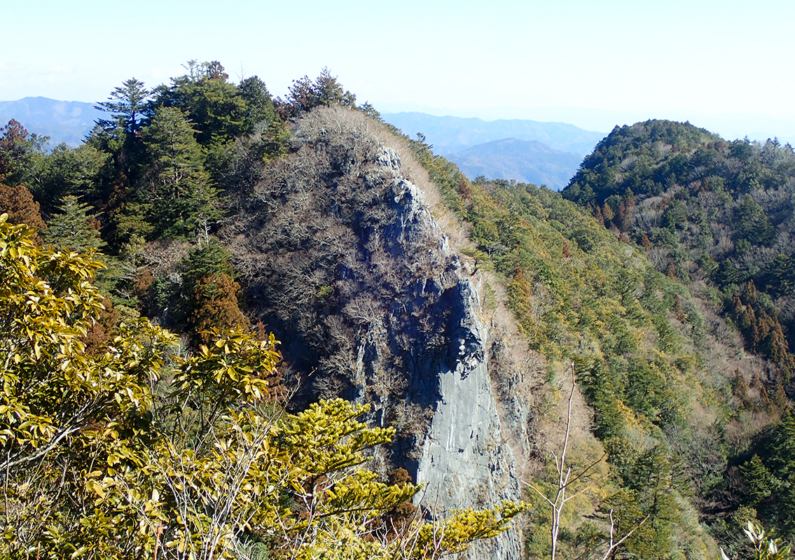 Fool-proof
Located in the central part of the summit of Yokogurazan, the 200-meter-high limestone slab that rises out of the earth's surface is a dazzling wall of sheer beauty. The average person is unable to easily reach the top, and those who take the risk of going to the tip are considered to be regarded as a kind of fools. Thus it became knows as “Fool-proof” because it was meant to test whether or not a person was a fool.
-
Antoku-sui (Water of Antoku)
This was named after the water that was offered to the Emperor Antoku when he and more than 80 other emperors, including Taira no Chimori, established their residence and capital in this area. In 1985, it was selected as one of the 100 best waters in Japan, and today it is loved as drinking water for hikers.
-
4
 Meotosugi
This is located about midway up the stone steps on the approach to Sugihara Shrine, with both trees merging at the trunk. Its deeply bound appearance seems to symbolize the eternal love of husband and wife.
-
5
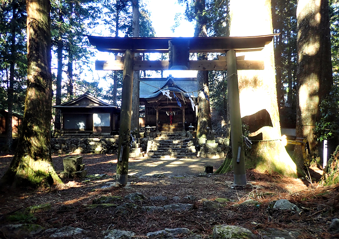 Sugihara Shrine
It was named for the many giant cedar trees that serve as a shrine to Kumano Gongen, the guardian deity of the Heike clan, and other deities. The Ancient Site of a Samurai House can also be seen nearby.
-
6
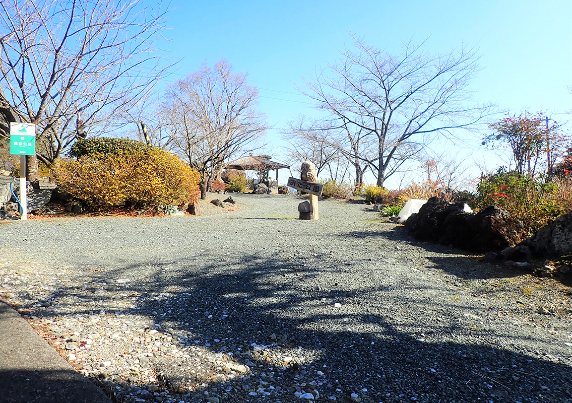 Oda Park Rest Area
Situated near the seventh station along Dosan Line (forest road Yokogura Choja Line), visitors can see the clear Niyodogawa, the urban area of Ochi-cho, the town of Sakawa, and the mountains of the Shikoku Mountains to the north. The park is planted throughout the year with flowers and trees of all seasons, including cosmos.

