Road Going Down the Old Misaka Pass
Road Going Down the Old Misaka Pass
This 9.5 km route starts from Misaka Pass (720 m above sea level) via Joruriji Temple No. 46 and reaches Yasakaji Temple No. 47. The mountain road about 2 km from Misaka Pass was once considered the most challenging road from Matsuyama to Kochi. Visitors can experience the antient times as the place still bears the traces of those days.
Road Going Down the Old Misaka Pass(9.5km)


※下記表はスクロールしてご覧ください。
 Spots to photograph
If you wish to receive a certificate, please take a photo that includes yourself at the designated photo point for each course.
Nearby sightseeing spots
-
1
 Starting point: Intersection with Route 33
The starting point of this route is the intersection with Route 33, which is marked by a large curve near the border of Kumakogencho, on the Kochi side of the Misaka Pass at an elevation of 720 meters.
-
2
 View from Misaka Pass
Matsuyama city is visible in the distance. The islands of the Seto Inland Sea can be seen beyond the city line.
-
3
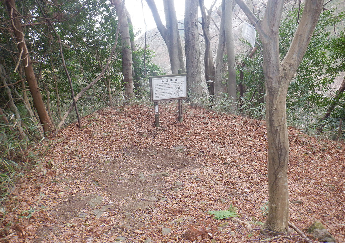 Kuma Highway
This was an indispensably essential route connecting Matsuyama, Kami-Ukuana-gun, and Kochi until the opening of the old Route 33 in 1892. The pilgrims cross this route on the way after visiting Iwaya Temple No. 45 and Joruriji Temple No. 46. It was once considered the most challenging road and still bears the traces of those days. You may want to be mindful about falling rocks and leaf litter here.
-
4
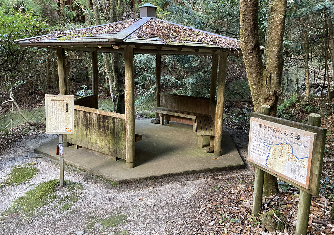 Sakura Rest Station (Ichino Ojisha Ato Rest Station)
Now you’ve arrived at Sakura rest station. A small cottage is provided for resting. They say that Ichino Ojisha once resided there.
-
5
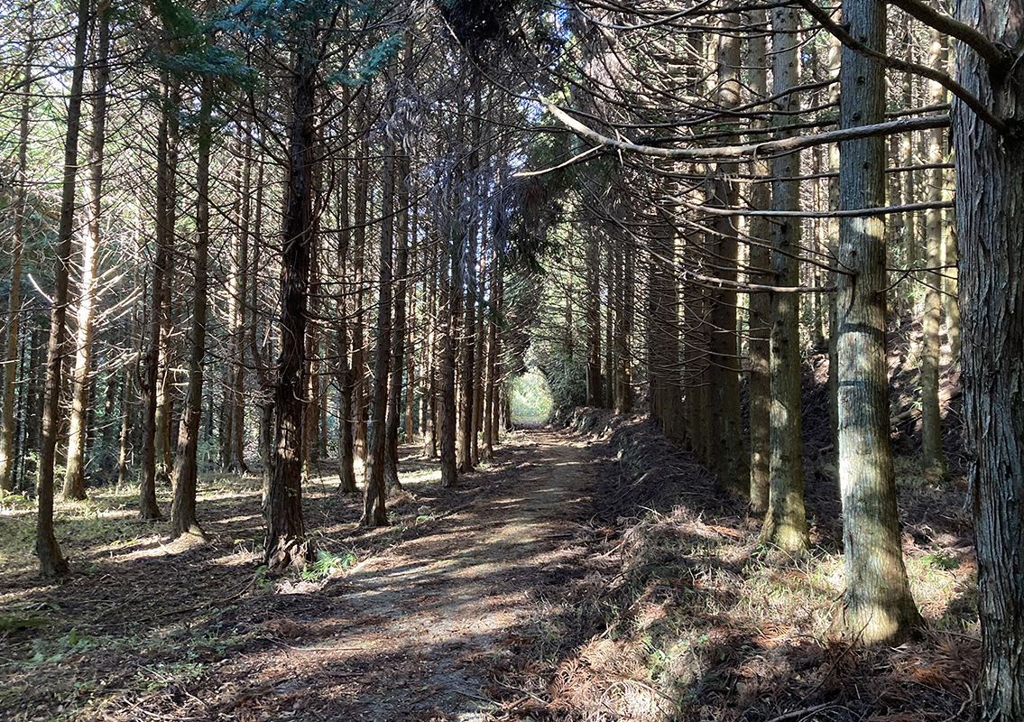 Sugibayashi Tunnel
This straight road through the cedar forest appears as if going through a tunnel. Occasional sunshine peeking through the trees creates a feel of magical landscape.
-
6
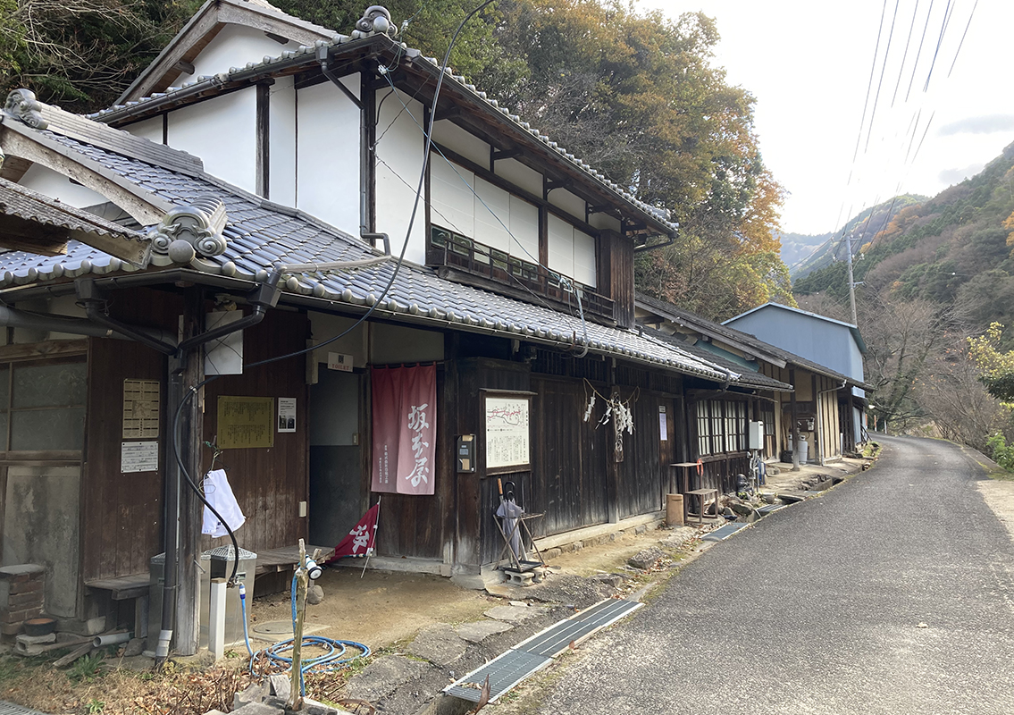 Sakamotoya, a former pilgrim inn
Sakamotoya is a pilgrim inn built in the late Meiji and early Taisho periods, located at the foot of the Misaka Pass, which is a difficult part of the highway. This inn was a busy place for resting and lodging until the early Showa period. You may use the restrooms restored and cleaned for use as a service station in 2004.
-
7
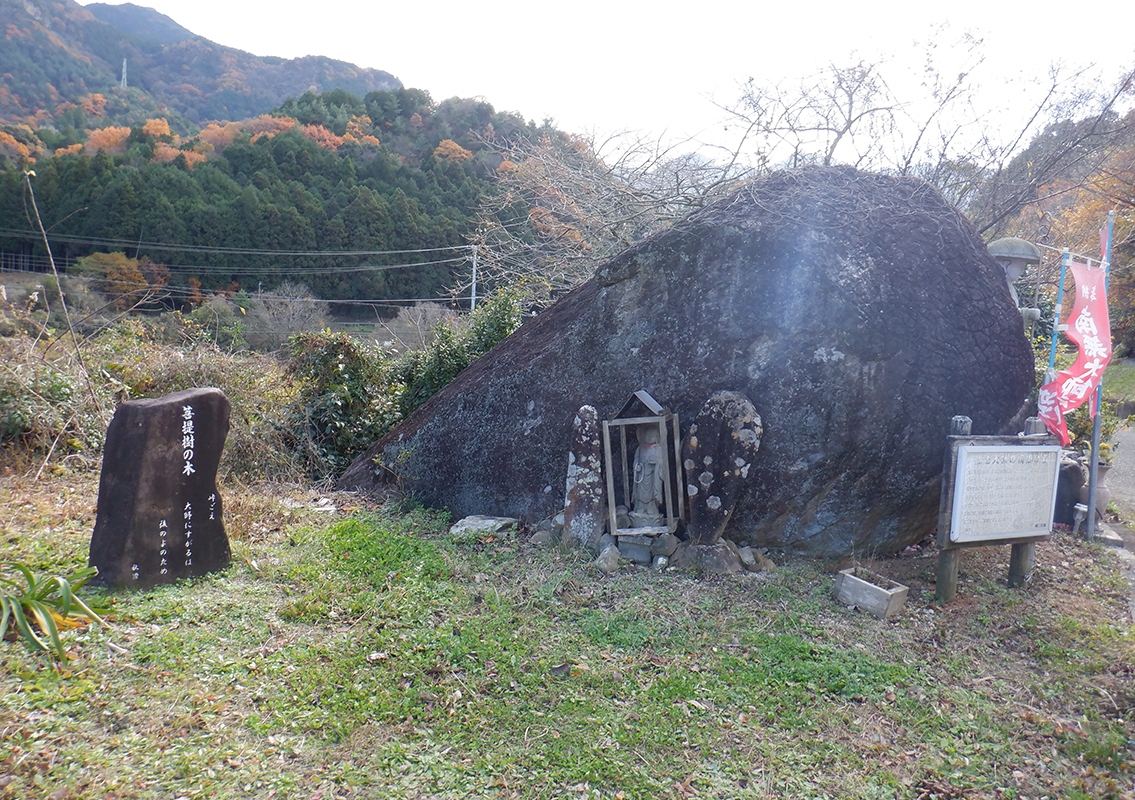 Amikakeishi
They say that Kobo Daishi once put a large stone in a net and carried it with poles. Eventually the pole broke and the place where it fell was called Okubo (Okubo, Hisaya-cho, Matsuyama City). The netted stone seen at the location is called so because of the numerous meshes on its surface and said to be one of the stones dropped by Kobo Daishi.
-
8
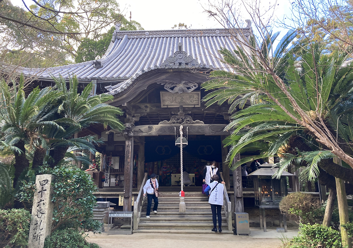 Fudasho Joruriji Temple No. 46
A 1000-year-old ibukijacin tree towers is in the center of the Joruriji temple grounds, and visitors can enjoy a variety of seasonal plants, including beautiful green trees, peonies in spring, and lotus flowers in summer. Buddha's hands (Busshuseki) and feet (Butsuzokuishi) on the road to the shrine are believed to bring blessings for wisdom, skill, and road safety. The Joruriji Temple grounds are expected to become a National Historic Site “Iyo Pilgrimage Route”. (Report by Council for Cultural Affairs, December 16, 2022)
-
9
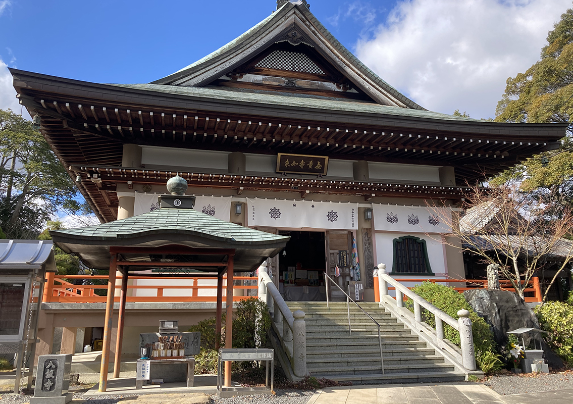 Fudasho Yasakaji Temple No. 47
This temple was named Yasaka-dera Temple in reference to the eight hills cut off to create the temple about 1,300 years ago. The main statue, a wooden Amida Nyorai in a seated position, is said to have been created by Genshin, a famous monk of Mount Hiei, and is a secret Buddha statue that is opened to the public only once every 50 years (the next time it will be opened is in 2034). The “path to paradise” and a “path to hell”, on both sides of Enmado Hall in the temple grounds are said to lead to the Pure Land of Paradise if one enters from hell and exits from paradise.

