Mitoko Exploration Route
Mitoko Exploration Route
You will arrive at the tranquil Nasa Bay if you head south on National Highway 55 from the Asa Coast Railway "Kaifu Station." From here, walk along the coastal national highway while enjoying the refreshing sea breeze to the Shishikuiohashi Bridge. You will see many surfers riding the waves at Ootekaigan in front of the Shishikuiohashi Bridge. Cross the Shishikui Bridge upstream of the Shishikuiohashi Bridge and head west to Suzugamine, where you will find the natural habitat of the Yakkoso plant, deemed to be a natural monument. As you pass under the Shishikuiohashi Bridge, you will see the Kasekirenkon (fossilized ripple marks) where traces of ancient waves were left on the rock bed. Mitoko Bay, dotted with large and small islands covered with green pines, will give you a mesmerizing view. The view of Takega Island from the Mitoko Rest Area is also outstanding.
Mitoko Exploration Route(16.3Km)


※下記表はスクロールしてご覧ください。
 Spots to photograph
If you wish to receive a certificate, please take a photo that includes yourself at the designated photo point for each course.
Nearby sightseeing spots
-
1
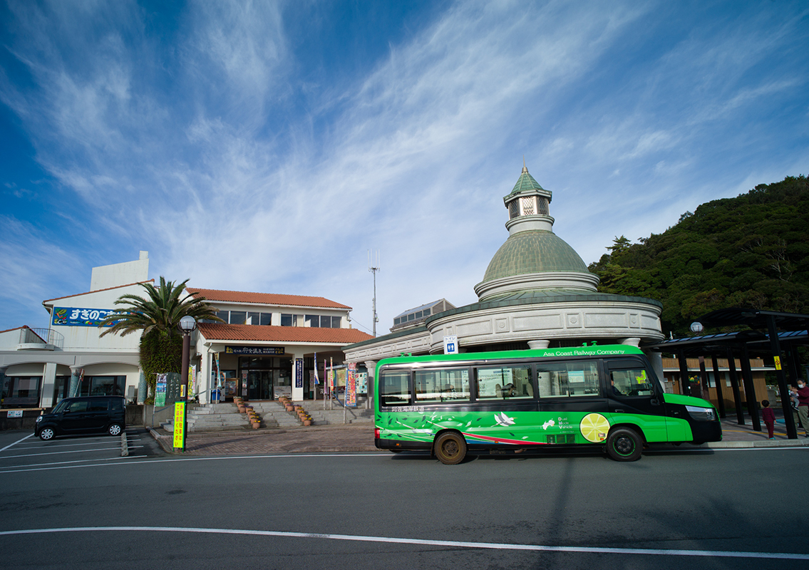 Roadside Station Shishikui Onsen (Michinoeki Shishikui) (Riviera Shishikui)
This Roadside Station has a tourist information center, stores, and a farmers’ market. The Asa Coast Railway, which runs in the area, was the first in the world to operate a DMV (dual-mode vehicle) that runs both on tracks and roads. It is in full-scale commercial operation here, and you can also get on and off at this Roadside Station. Visitors can experience the "mode change," which switches the vehicle between railway mode and bus mode, at two locations: "Awa-Kainan Station" and "Kannoura Station."
-
2
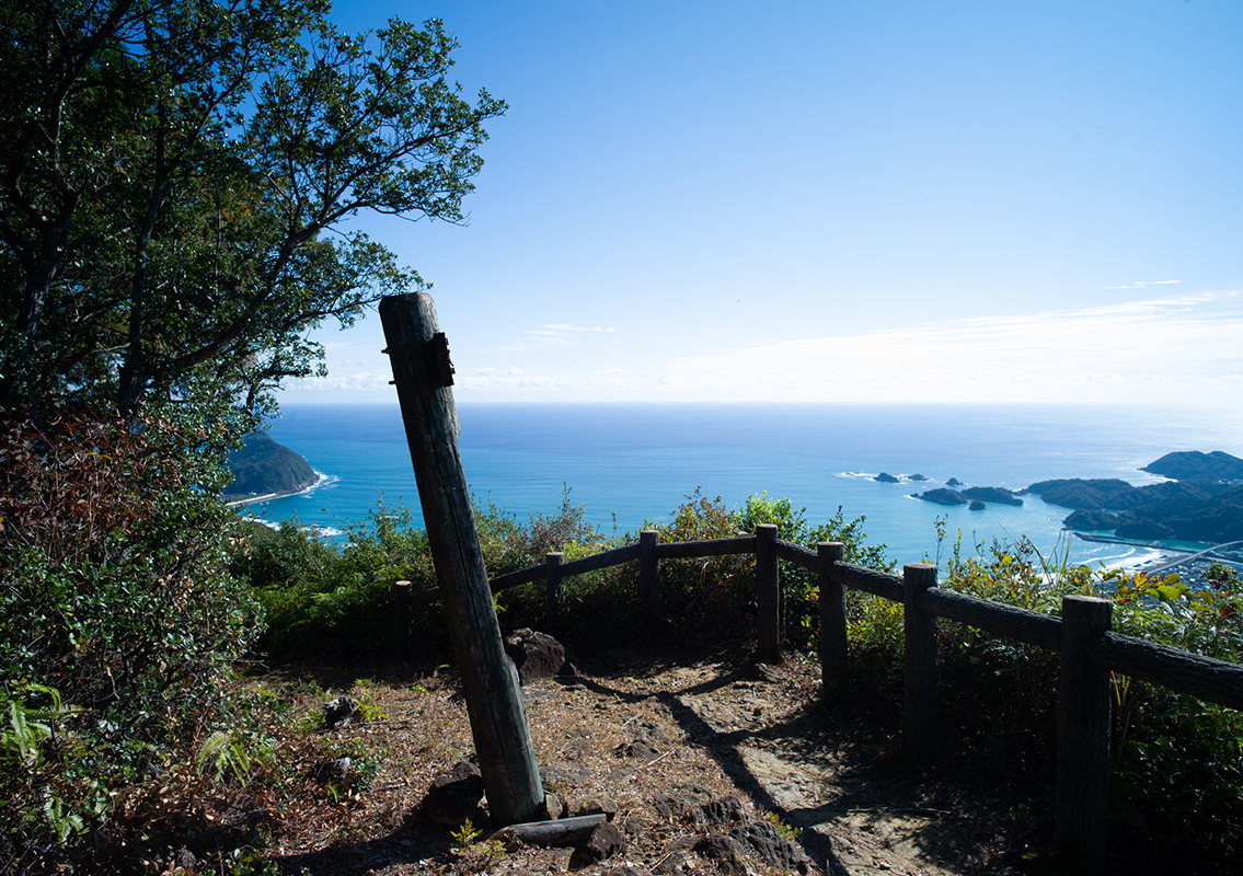 Suzugamine
Situated on the border of the former Kaifu and Shishikui Towns, the area near the mountain's summit, which is about 395 m above sea level, is covered in evergreen, broad-leaved trees such as the Japanese Chinquapin. The forest is home to rare plants such as the "Yakkoso." Suzugamine is designated as a national natural monument for being the habitat of the Yakkoso plant.
A statue of Kannon is enshrined in the temple at the summit, which is the site of the Entsuuji Temple. It was once famous as a mountain of worship, and many pilgrims visited it during the Meiji period. -
3
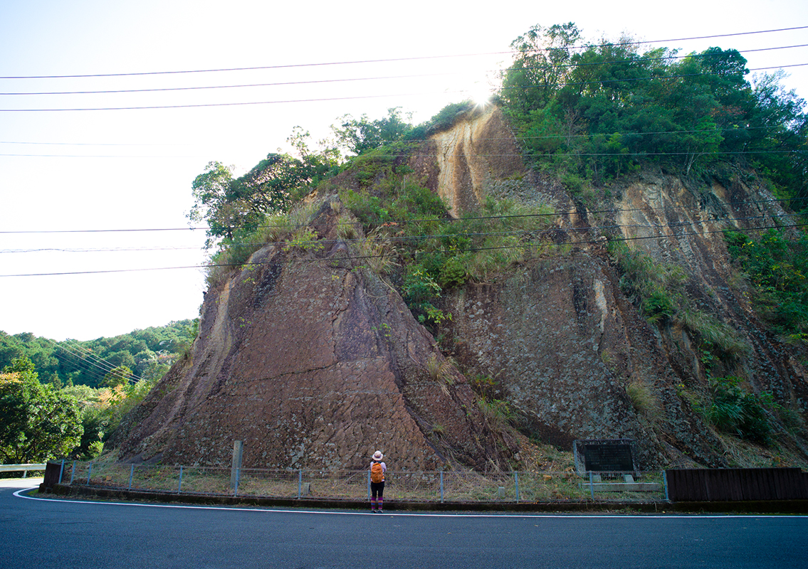 Kasekirenkon (Fossilized Ripple Marks)
These marks were discovered during the excavation of the old national highway (currently No. 55) in the early Taisho era after they were exposed above ground. Fossilized traces of "ripples" remain on the thin surface of the sandy shale rock. During the Tertiary Eocene geological period (about 30 to 40 million years ago), this area was below the sea, and waves went over the sediments deposited on the ocean floor, creating wave-shaped layers (ripple marks). Subsequent tectonic movements caused the ocean floor to rise above the surface, giving it its current shape. At 30 m high and 20 m wide, the Kasekirenkon is one of the largest natural structures in Japan and has been designated a national natural monument.
-
4
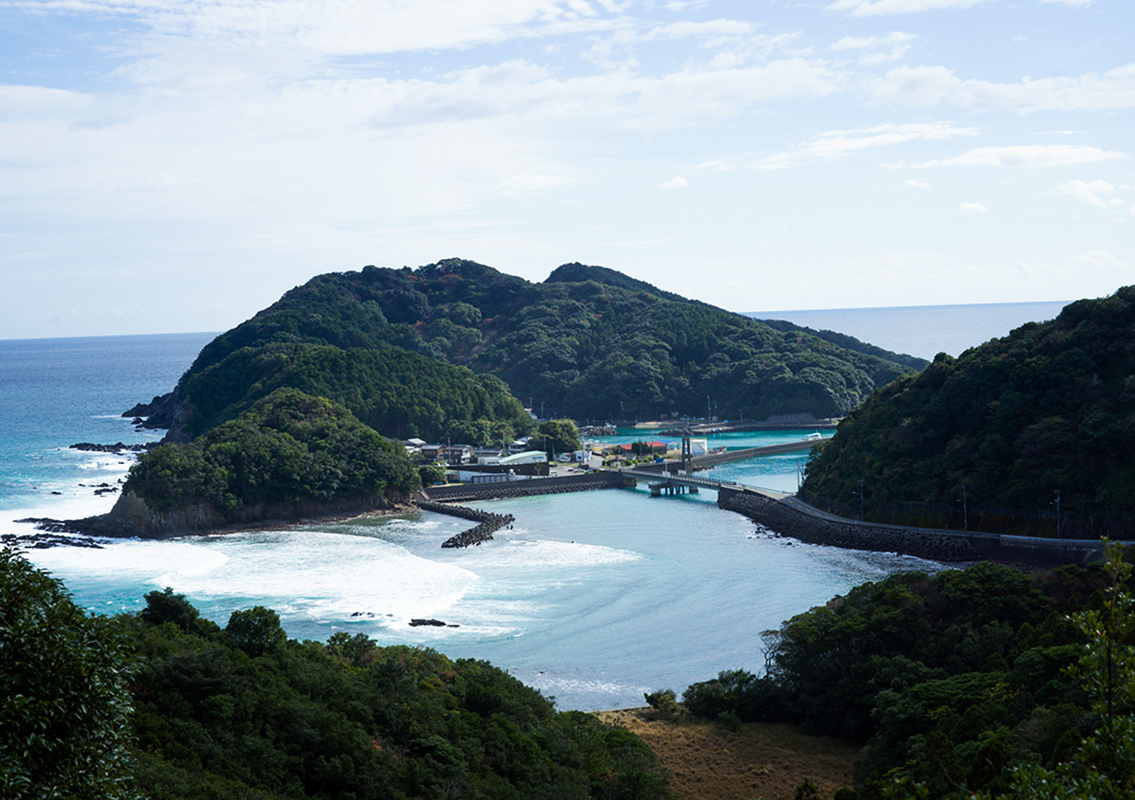 Takega Island
This remote island is located about 100 m offshore from the cape at the southernmost tip of Shishikuiura in Kaiyo Town. The size of the island is about 1 km from north to south and 700 m from east to west, with an area of about 0.4 km². The island is located in the Muroto-Anan Beach Quasi-National Park, and the surrounding waters are known to be home to colonies of stony corals. The underwater sightseeing boat "Blue Marine" that tours the Takegashima Marine Park takes a leisurely 45-minute cruise through the marine park. You can see brightly colored fish such as the neon damselfish and clownfish swimming around up close from the window on the bottom of the boat.
Built in the northwestern part of the island near the Takegashima Harbor, since ancient times, the Takegashima Shrine has enshrined three deities of Kuninotokotachi-no-kami, Okuninushi, and Kotoshironushi-no-kami as guardians for maritime safety and plentiful seafood catch.

