Saga Road
Saga Road
This route goes through the mountainous area of the southwest part of the prefecture but heads down south along the Iyoki River, so the path is relatively flat for a mountainous region. Because the National Road 56 is nearly parallel to the river, there is very little traffic and you can take your time enjoying the endless greenery of the mountains and river. You can also enjoy manmade structures in the villages and fields bordering the road.
Walk along the flat road until you reach Kumai, the only area you need to cross a mountain to get on the Saga Road. Also serving as the Pilgrimage Road, it has a steep incline and once you get through Kumai Tunnel halfway up the mountain, you will arrive at Tosasaga Station. Not only can you view the Pacific Ocean as you stroll down, it also connects to the Road to Tosa Irino Matsubara.
Saga Road(15.3km)


※下記表はスクロールしてご覧ください。
 Spots to photograph
If you wish to receive a certificate, please take a photo that includes yourself at the designated photo point for each course.
Nearby sightseeing spots
-
1
 Suribachi Todoroki Falls
Although it departs slightly from Saga Road, the waterfalls that are about 3 km north of Ichinose, the departure point, has a height of 54 m. The sound of the endless falling water forcefully echos through the mountains, giving you an incredible natural experience. The path to the waterfall is not an easy one and includes places with unstable footing, steep inclines and river crossing. Make sure to wear shoes with thick soles that you can wade in water with.
-
2
 Grave of Runin Manroku
In the mountains of Kokurono River along National Road 56, and he was said to have been exiled from Tosa-cho. Said to be "Dokure" (Kochi dialect for "stubborn") and witty, and liked by everyone. Lay to rest here in 1850 (3rd year of the Kaei era).
-
3
 Kumano Shrine
Around 800 years ago, after the Genpei War, Benkei’s father, Tanzo, landed at Kumanoura from Kishu Tanabe. In Bunji 2 (1186), he moved to Kumai and enshrined Kumano Gongen on Mt. Hosenji. As the shrine on top of the mountain, every summer and autumn (August 1st, and November 12th), big festivals for traditional events are held, where a 4 m high Cow Demon marches through the town, praying for health and safety from disasters.
-
4
 Iyoki Tenmangu Shrine Rest Area
This is a great spot located inside Iyoki Tenmangu Shrine where you can look over Iyoki River. Take a quick break and then head to the next sight.
-
5
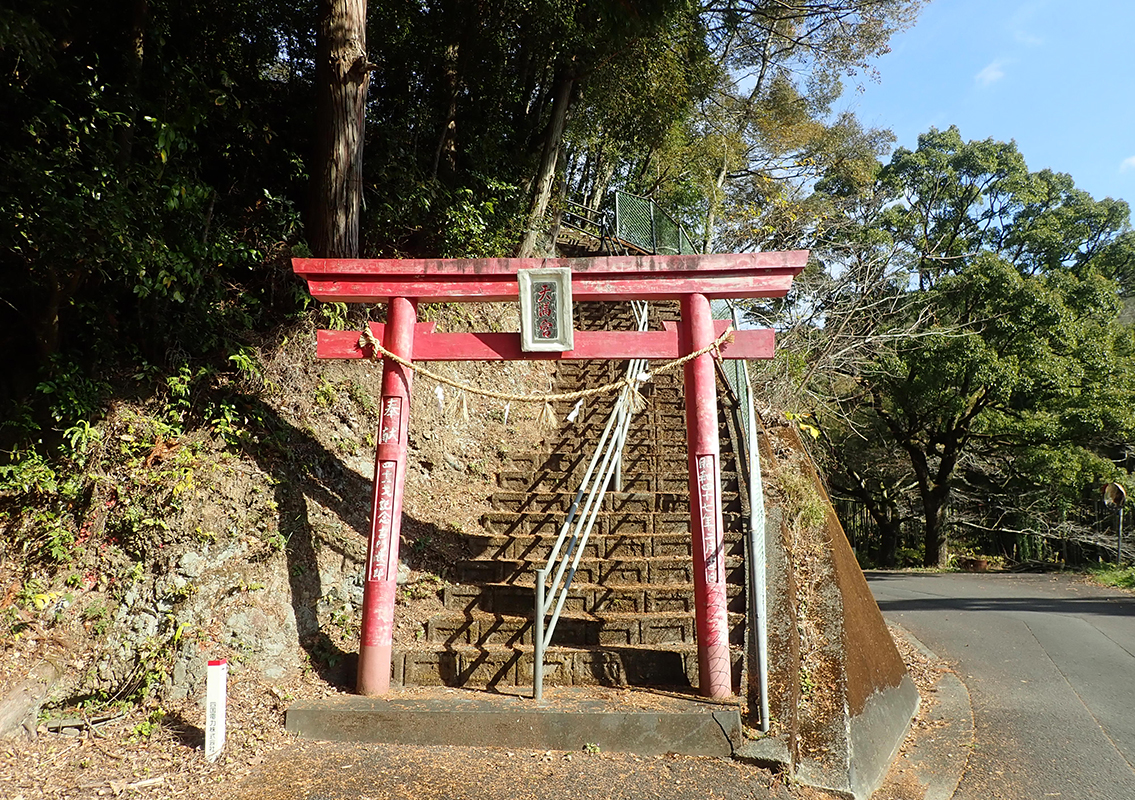
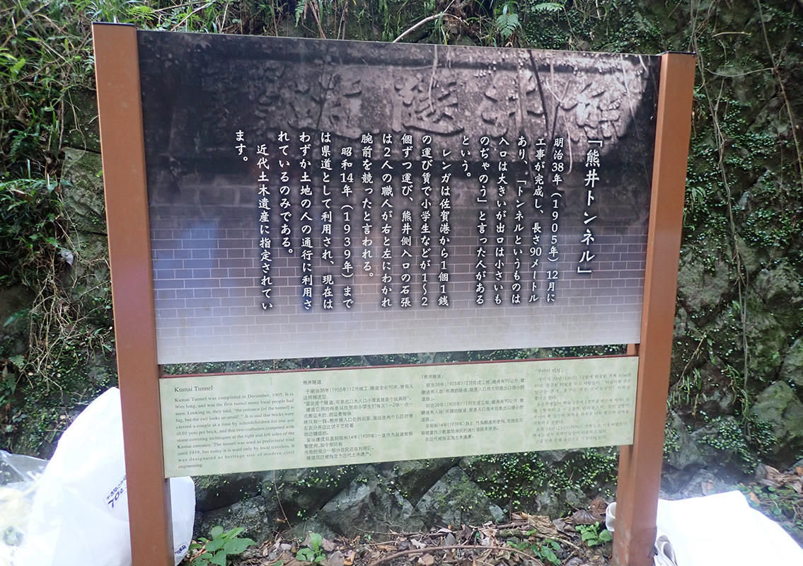 Kumai Tunnel
The construction of this tunnel was completed in the month of December in Meiji 38 (1905), and the story goes that someone said at the time, "Tunnels are meant to have large entrances and small exits." The bricks used in the 90 m-long tunnel were even said to have been carried by elementary school students, 1 or 2 at a time, from Saga Port, for a carrying fee of 1 sen per brick. Until Showa 14 (1939), the tunnel was used as a prefectural road. At present, it is a designated Civil Engineering Heritage site.
-
6
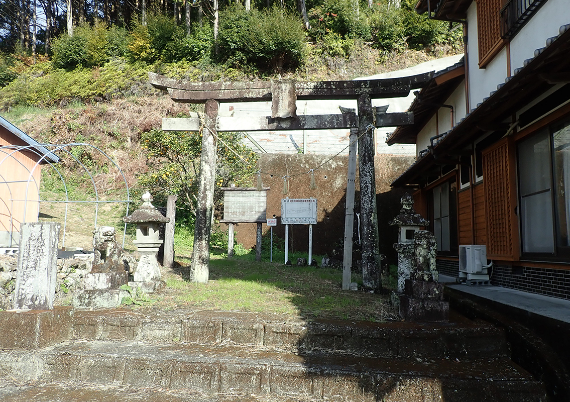
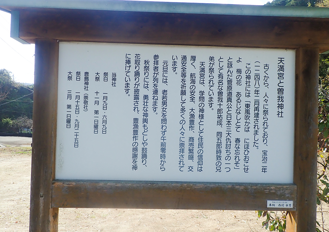 Tenmangu and Soga Shrines
Enshrined together around Hoji 2 (1248), the shrines have been a place of worship ever since. The shrines are dedicated to Sugawara no Michizane, who composed the verses
"When the east wind blows,
flourish in full bloom,
you plum blossoms!
Even though you lose your master
don't be oblivious to spring,"
and to the Soga Brothers, who were part of one of the three major vendetta incidents in Japan. During the Autumn festival, lively shrine-carrying processions, folk dances with drums, and Hanatori-odori dances are put on to thank the gods for bountiful harvests and fishing. -
7
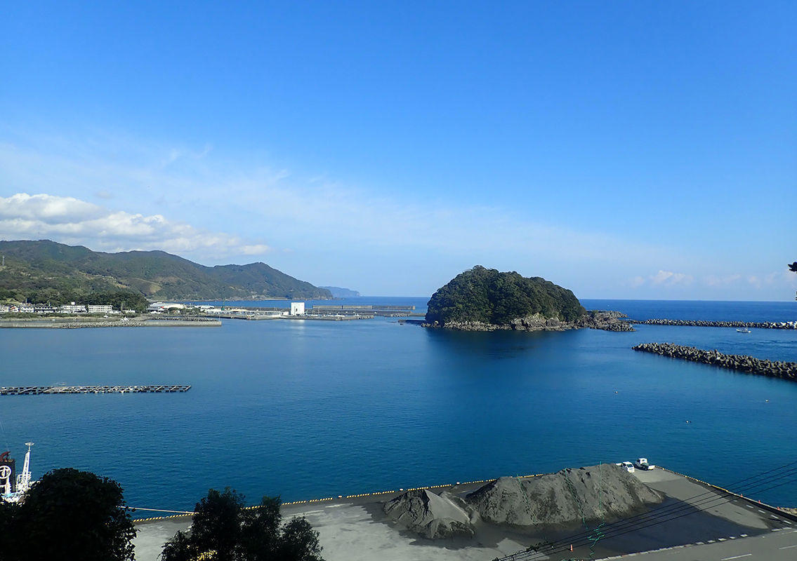 Kashimagaura Bay
The Saga Port area is called Kashimagaura Bay and is a well-known scenic spot. At the entrance of the port are the opposing forms of Kashima and Itsukishima. Kashima’s primeval forest is Kuroshio town's natural monument and is a designated "nature conservation area" in Kochi Prefecture. You can enjoy sweeping views of the scenery from the observation deck in 'Tosa Seinan Great Park (Saga district).'

