The Road to the Two Mima Basin Temples
The Road to the Two Mima Basin Temples
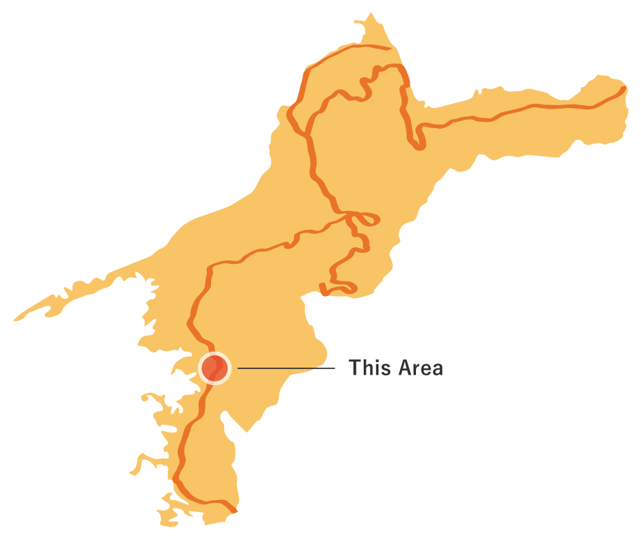
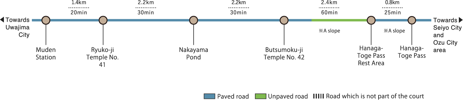
The Road to the Two Mima Basin Temple in Ehime Prefecture is the third route on the Shikoku no Michi Trail. It begins in front of Muden Station. Flanked by the sprawling, peaceful landscapes of the country, the route will take you from Ryuko-ji Temple to Butsumoku-ji Temple. On the way, you will encounter Nakayama Pond, created by village headsman Yuen Dazai over four years. Both sides of the road leading to Butsumoku-ji Temple are lined with cosmos flowers, which bloom in the fall to create a "cosmos highway." A steep mountain trail continues for about 2km after the cosmos highway. Once you surmount that, you will arrive at the last stop, the Hanaga-Toge Pass. Part of the Hoketsu Mountain Range, the Hanaga-Toge Pass is key for transportation between Mima, Uwajima and Uwa, Seiyo. It is said that, until the Prefectural Mima Route was connected in 1970, the old pilgrimage path was the only road. From here, you can look out over the ria coastline of Ashizuri Uwakai National Park. The Onigajo Mountain Range is also visible in the distance. At the base of the Hanaga-Toge Pass, there are remnants of an old-growth sawtooth oak forest, and cherry trees grow on the pass itself. With each season, the scenery on the route changes. The autumn colors and ripening mandarin oranges make a particularly delightful sight. The last stop is in front of the Hanaga-Toge Pass tunnel. From there, the trail splits into two routes: the Hoketsu Bay Observation Corridor, and the Uwa Home of Culture and Pilgrimage Trail. The Hoketsu Bay Observation Corridor is currently closed due to damage from heavy rain in July 2018.
The Road to the Two Mima Basin Temples(9.0km)


※下記表はスクロールしてご覧ください。
 Spots to photograph
If you wish to receive a certificate, please take a photo that includes yourself at the designated photo point for each course.
Nearby sightseeing spots
-
1
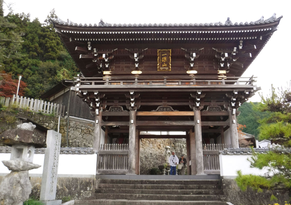
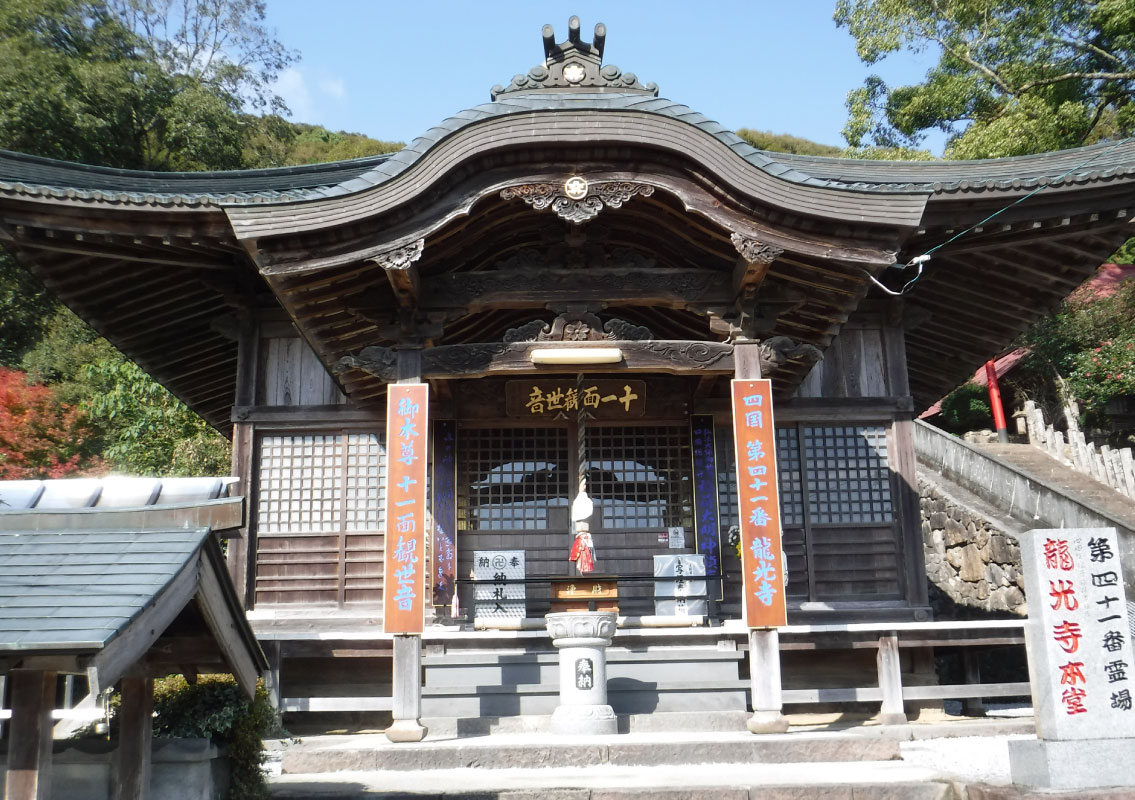 Ryukoji Temple
Ryukoji Temple is the 41st temple on the Shikoku pilgrimage. Located on a small hill that overlooks the fields of Mima, the shrine is called "Oinari-san" by locals. There is a legend that, long ago, the village headsman was attacked by a dragon just after falling asleep in the dry riverbed here. He instinctively pulled out his sword from its scabbard and gouged out the eye of the dragon, which he presented to the shrine as an offering. The shrine is believed to provide protection for Mima's farmers. In 807, after Kobo Daishi had a revelation during a pilgrimage to this area, he carved a statue with his own hands and erected a temple to enshrine it. He called the temple Inarizan Gokokuin Ryukoji Temple. There is an Inari shrine in front.
-
2
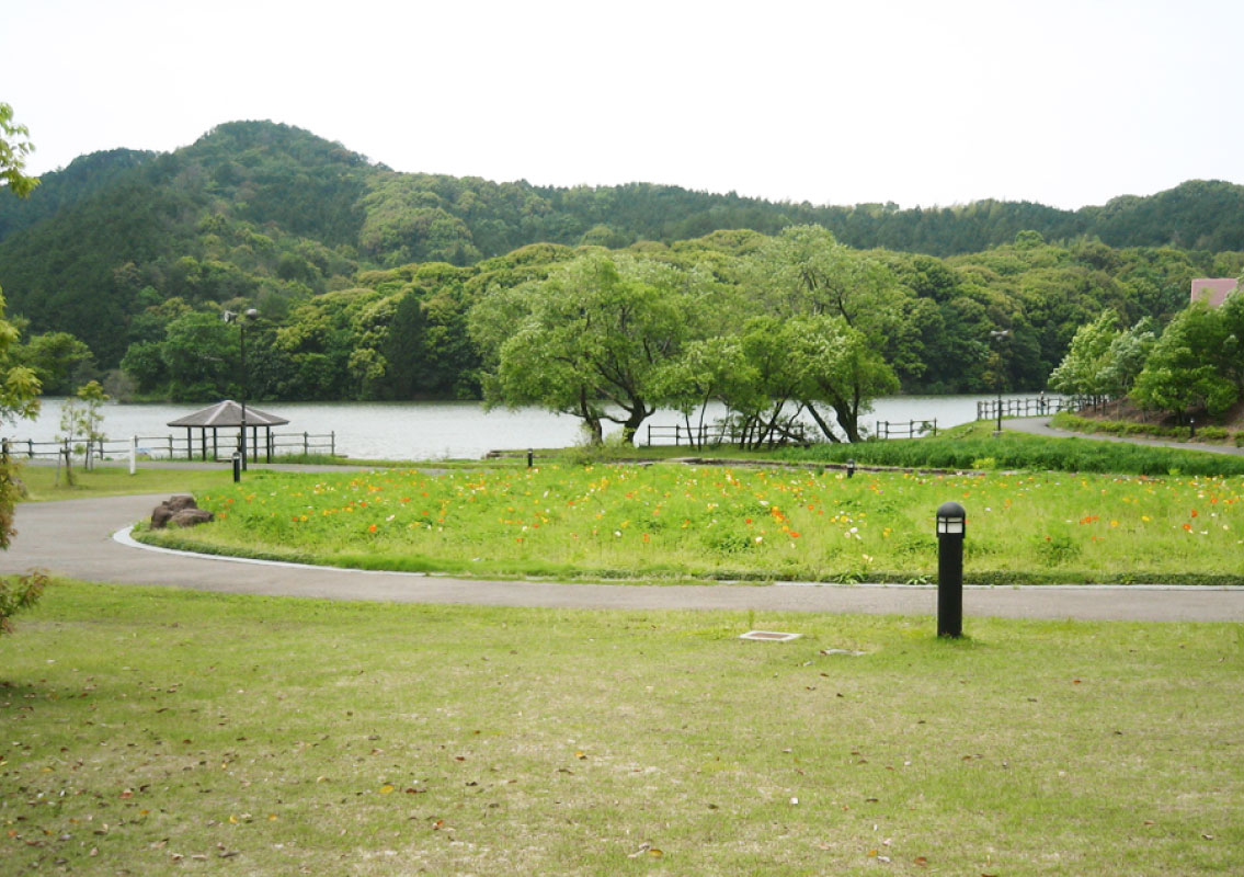 Nakayama Pond
Mima, Uwajima is home to many reservoirs, but Nakayama Pond has the largest water capacity of them all. Long ago, frustrated by the poor access to water in the region, village headsman Yuen Dazai decided to create a reservoir for irrigation. Construction began in 1627, and by 1630 Nakayama Pond was complete. Even today, the reservoir provides water for 100 hectares of paddy fields. A cosmos festival is held each year on the first Sunday of November, with festivities centering on the Nakayama Pond Nature Park. The nature-rich area around the pond is maintained as a public park.
-
3
 Butsumokuji Temple
Butsumokuji Temple is the 42nd temple on the Shikoku pilgrimage. Founded by Kobo Daishi, it is affectionately known as "Odainichi-san." Originally, worshippers at the temple prayed for protection for their horses and cattle, but there are no longer many farmers with horses or cattle here. During the "urifuji" ceremony held on the day of the ox in the six month of Japan's lunisolar calendar, illnesses of humans, horses and cattle are sealed in melons and set adrift on the river. There are also some unusual memorials to livestock on the grounds.
-
4
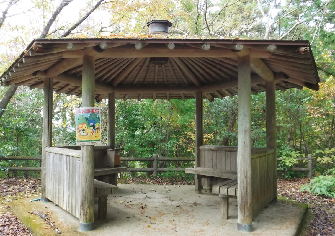 Hanagatouge Pass Rest Area
This is a rest area at the Hanagatouge Pass. The inconspicuous arbors and benches in the forest are the ideal place to take a break.
-
5
Hanagatouge Pass
With an altitude of 490m, this mountain pass overlooks the Hoketsu Bay and provides a sweeping view of Ashizuri Uwakai National Park's ria coastline. The seasonal scenery is exceptionally beautiful, from the fresh verdure of spring to the red leaves of autumn and the ripening of the mandarin oranges.

