Pilgrimage Road Leading to Kumago Mountain Temple
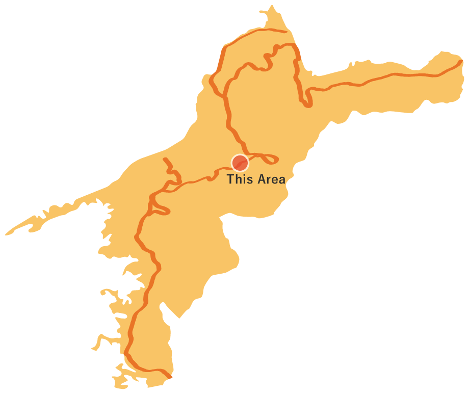
Pilgrimage Road Leading to Kumago Mountain Temple
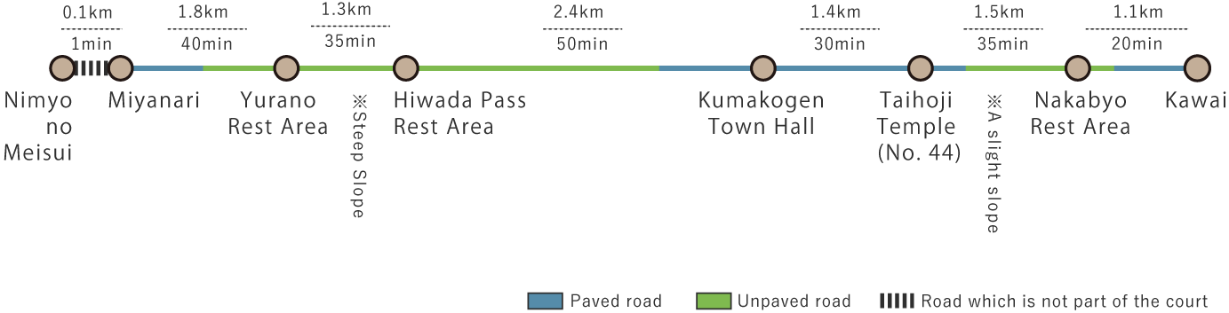
This route begins in the Miyanari area, known for its abundant spring water, and ascends the mountain path to Hiwada Pass. As you descend from the pass, you can enjoy a distant view of Kumakogen Town. After reaching National Route 33, the path goes through a residential area and the town office before leading into a forest of cedar and cypress trees, where the 44th temple, Taihoji, is nestled in a tranquil, mountainous backdrop. The route then ascends again, passing through the Nakabyo Rest Area, continuing towards Kawai, covering a total distance of 9.5 km.
Pilgrimage Road Leading to Kumago Mountain Temple(9.5km)


※下記表はスクロールしてご覧ください。
 Spots to photograph
If you wish to receive a certificate, please take a photo of yourself at the designated photo point on each course.
Nearby sightseeing spots
-
1
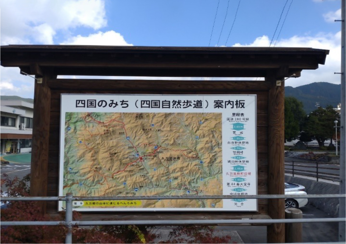
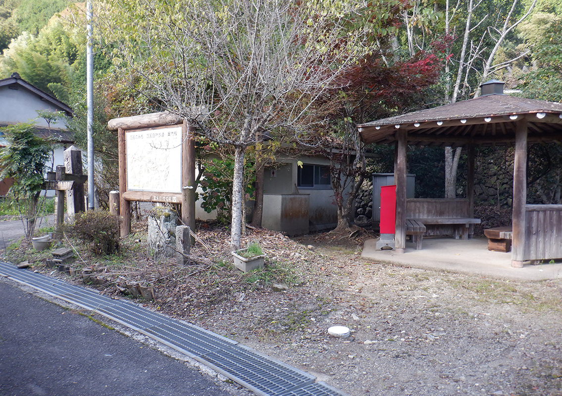
 Starting Point: Miyanari (Information Board)
This area is known for its famous spring water, called Nimyo no Meisui. The water flows through a stone channel set into the mountainside. About 500 meters northwest along Prefectural Route 42, there is an intersection with a town road where an information board marks the starting point.
-
2
 Yurano Rest Area
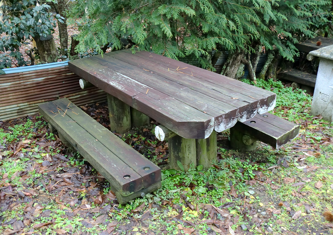
A picnic table is set in a quiet forest spot dappled with sunlight filtering through the trees. Before tackling the steep mountain path to Hiwada Pass, this is a good place for a break.
-
3
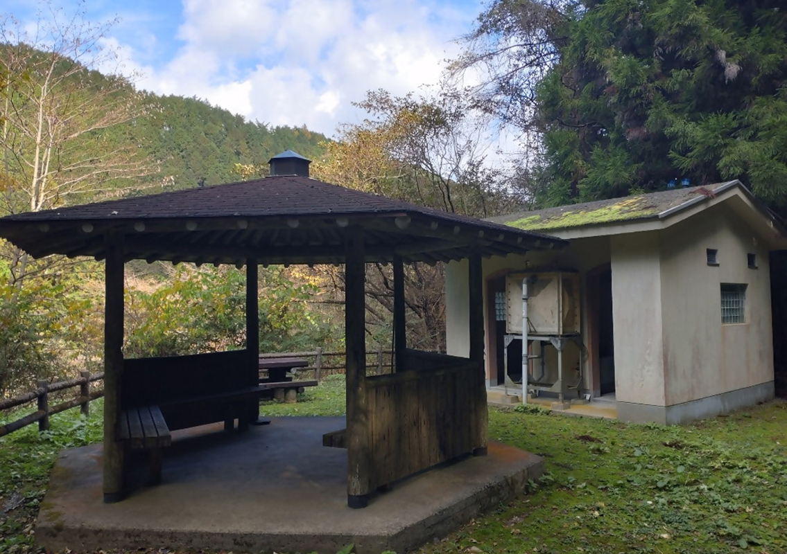 Hiwada Pass Rest Area
The Hiwada Pass sits at an altitude of 800 meters and was once a key route connecting the Nimyo and Kuma districts. Until around the 1950s, a teahouse stood at the pass, offering travelers a place to rest. One theory about the name "Hiwada Pass" suggests that Kobo Daishi, the founder of the 88-temple pilgrimage, encountered continuous rain from Ozu, but finally saw clear skies here, exclaiming "Hiwari da!" (Good weather!), which later evolved into "Hiwada." A short descent from the pass leads to a rest area equipped with public toilets and a gazebo.
-
4
 Kumakogen Town Hall
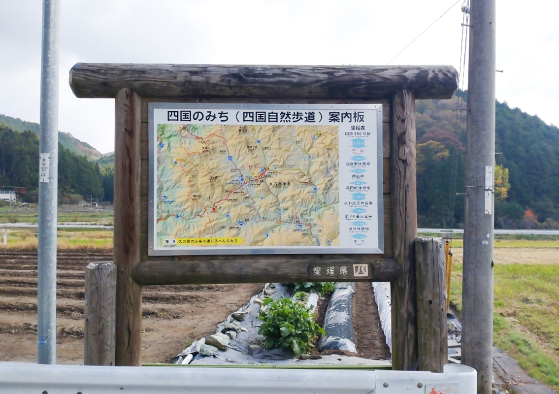
A prominent information board is set up in front of the Kumakogen Town Hall along National Route 33.
-
5
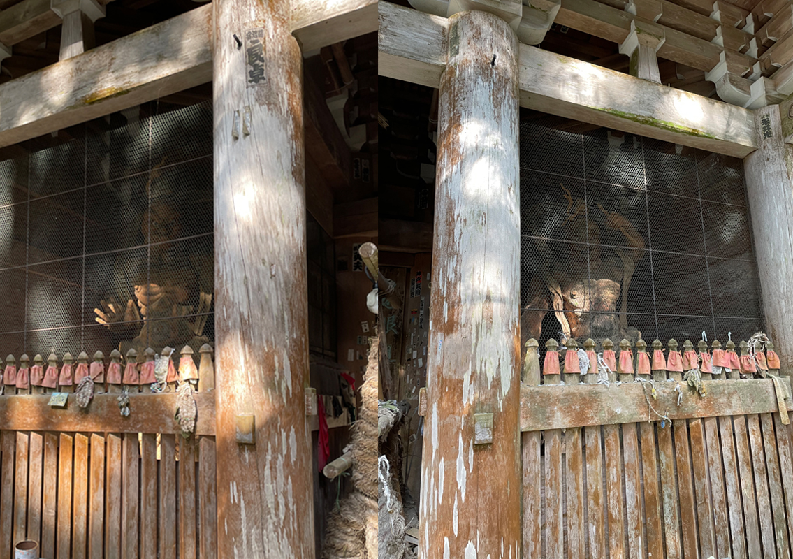 Taihoji (No. 44) - Kongorikishi Statues
At the entrance of Taihoji Temple, stand two Kongorikishi guardian statues, designated as important cultural assets of Kumakogen Town. The statue on the right holds a Vajra in its left hand and has its mouth open as if shouting, while the statue on the left has its fingers extended and mouth closed, appearing stern. The open-mouthed statue is called "Agyo," while the closed-mouth one is "Ungyo."
-
6
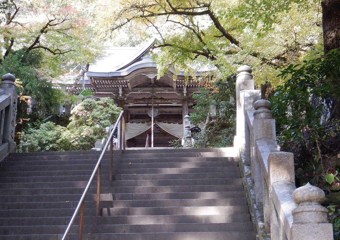 Taihoji Temple (No.44)
The 44th temple, Taihoji, was founded in the first year of the Taiho era (701) under Emperor Monmu when a Baekje monk brought an Eleven-Faced Kannon statue and enshrined it here. The temple's 33 stone lanterns are a designated cultural heritage site of the Prefecture. This distinguished Kegon temple is surrounded by towering cedar trees.
-
7
 Nakabyo Rest Area
This rest area has one bench and two picnic tables. From here, the path descends for about 1 km to the endpoint.
-
8
 Endpoint: Kawai Rest Area
This is the endpoint of the route and serves as the starting point for the next route. Enjoy your continued journey on the Shikoku Nature Trail!

