Yadoyasugi Trail
Yadoyasugi Trail
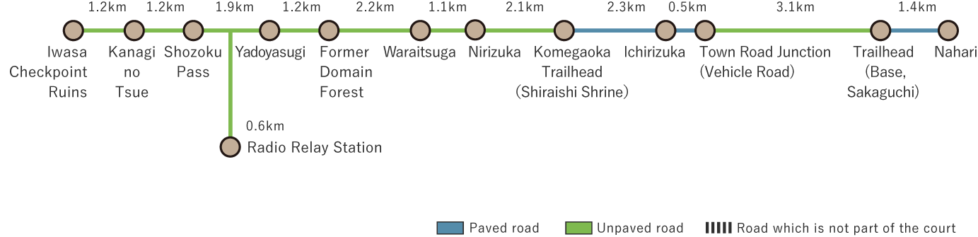
This route covers the western half of the Noneyama Highway, which was once used for sankin-kotai (travel for alternate attendance) by feudal lords. The 18.8 km mountainous course, which stretches from Kitagawa Village to Nahari Town, is one of Kochi Prefecture's most difficult trails, complementing the Iwasa Checkpoint Trail. After passing the Iwasa Checkpoint and climbing uphill, you will reach Shozoku Pass, the highest point on the highway at 1,082 meters, where an observation deck offers panoramic views of the surrounding mountains. About 2 kilometers further lies Yadoyasugi, a massive cedar where travelers once took shelter overnight. The tree's hollow trunk is large enough to sleep inside, and stepping inside will transport visitors back in time. After leaving Yadoyasugi, the trail descends all the way to Nahari town. Along the way, you'll find resting spots such as Asayasu Miba and the remains of old teahouses, making this a rare historical nature trail that preserves the atmosphere of the sankin-kotai era.
Yadoyasugi Trail (18.8km)


※下記表はスクロールしてご覧ください。
 Spots to photograph
If you wish to receive a certificate, please take a photo that includes yourself at the designated photo point for each course.
Nearby sightseeing spots
-
1
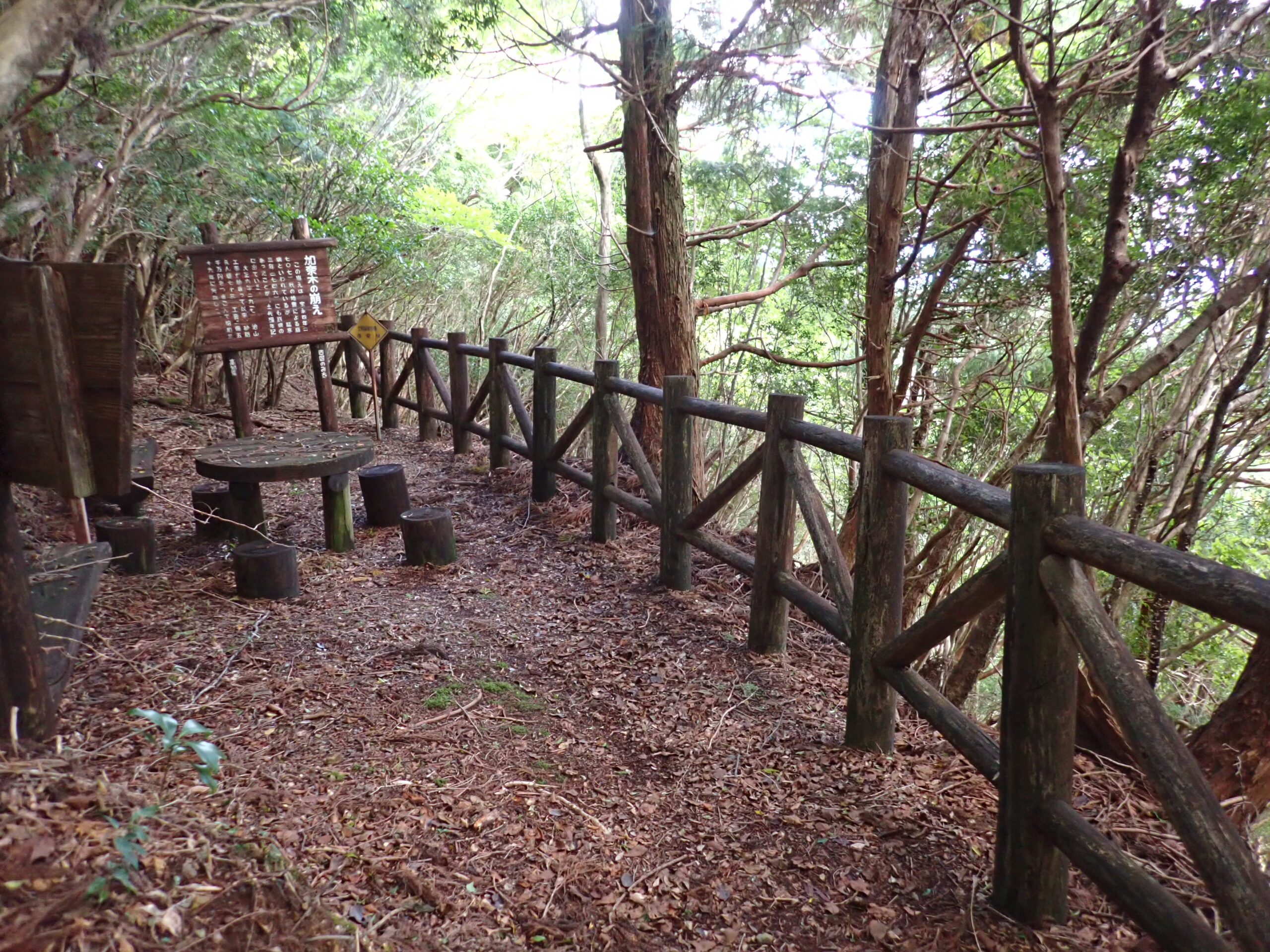 Kanagi no Tsue
This tsue (landslide) is believed to have been caused by the Hoei Earthquake in the mid-Edo period. Erosion control work began in 1917, and by 1964, 73 check dams had been built at a total cost of 2.5 billion yen.
-
2
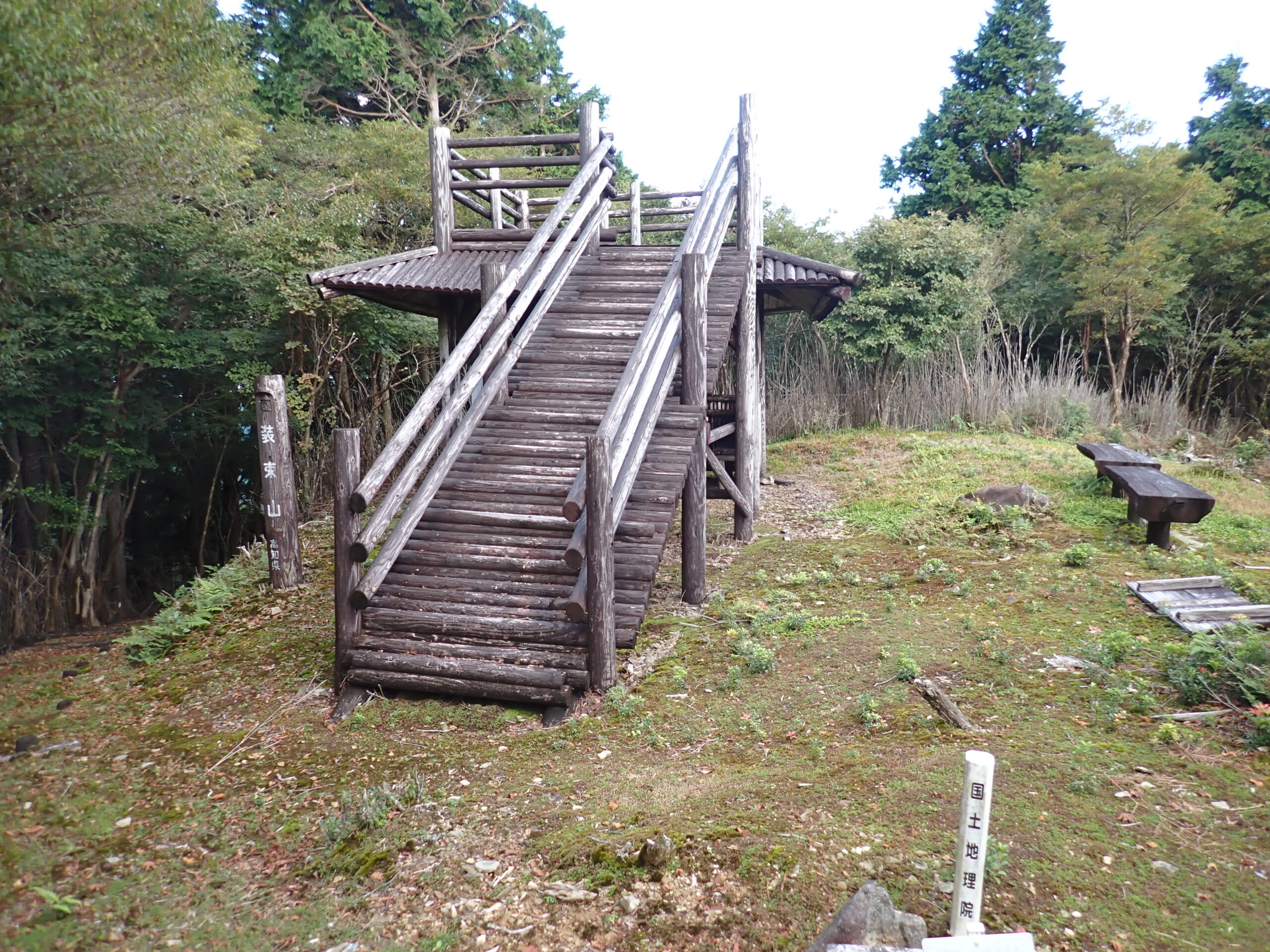 Shozoku Pass
Shozoku Mountain, at 1,082 meters, is the highest point along the highway, with an observation deck at its peak. The pass (Shozoku meaning "attire" or "costume") is said to have been named after the practice of feudal lords changing their travel attire here on their way back from sankin-kotai (travel for alternate attendance). Another theory suggests that brides crossing the mountain for their wedding changed into bridal attire at this spot.
-
3
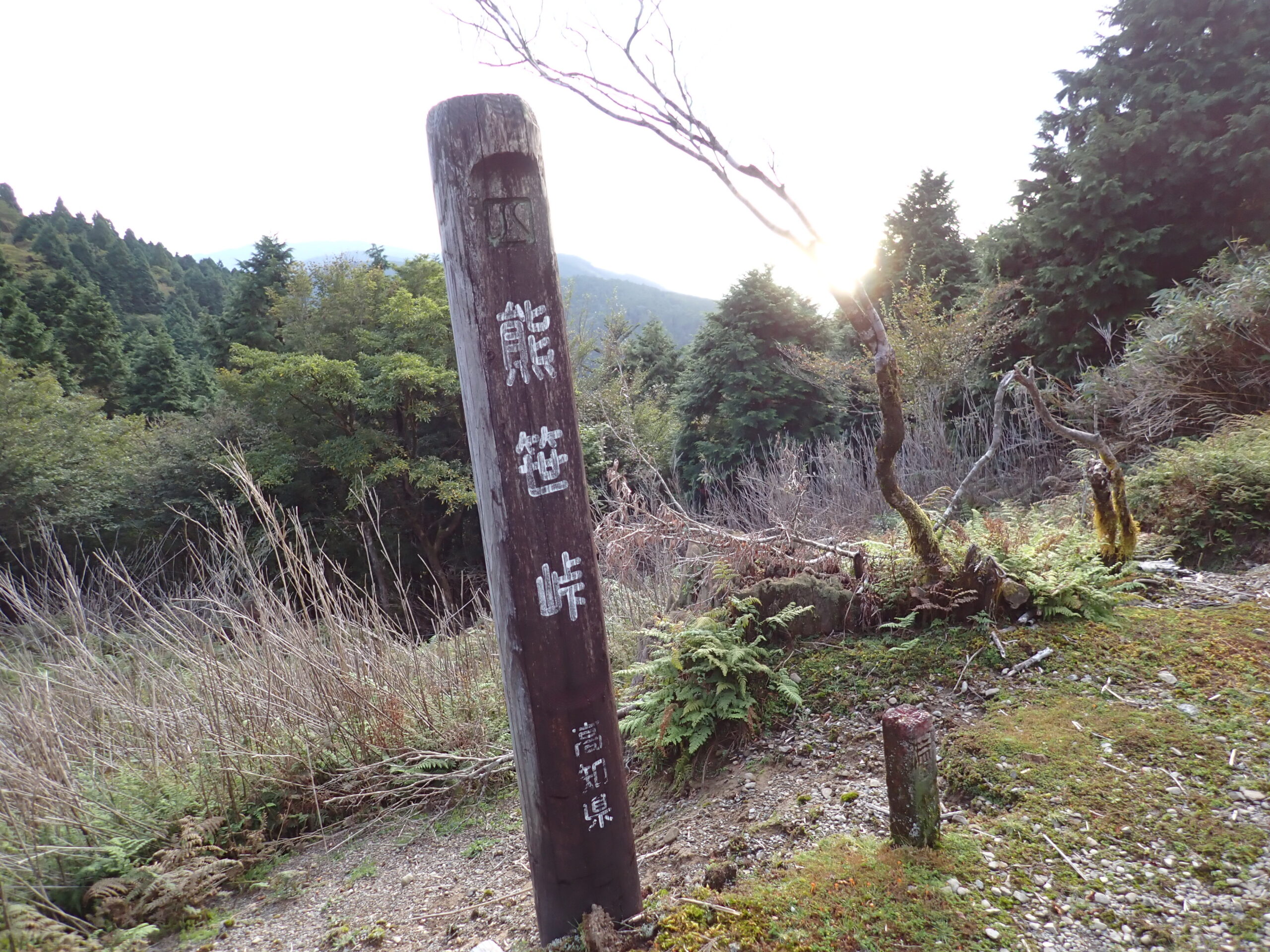 Kumazasa Pass
From Kumazasa Pass, known for its beautiful kuma bamboo grass, you can enjoy stunning views of the Geito region, and on clear days, you can even see the Pacific Ocean.
-
4
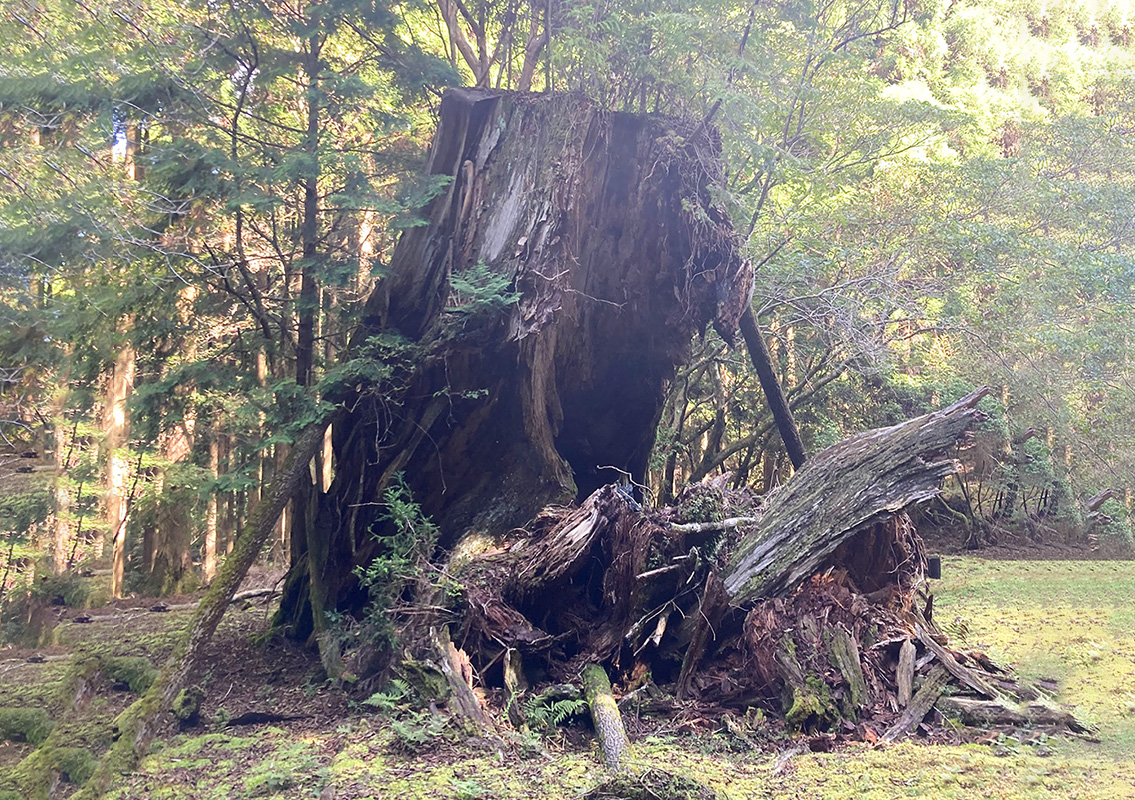 Yadoyasugi
Sadly, this ancient cedar collapsed during the Muroto Typhoon in 1934. However, it once stood 32 meters tall with a trunk circumference of 16.6 meters at chest height and was believed to be over 1,000 years old. Even today, its massive hollow base remains large enough for someone to sleep inside.
-
5
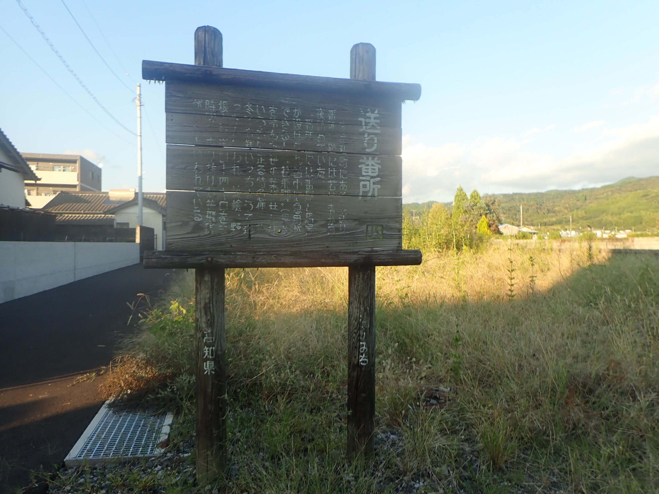 Okuribansho Guardhouse Ruins
The Okuribansho Guardhouse in Nahari Town housed both a police box and a stable. In times of urgent national business, special couriers (sasa hikyaku) (express couriers who would arrive before the bamboo leaves containing the notes dried out) were dispatched, running nearly naked in only a fundoshi undergarment even in winter. Some were said to have covered the 35 km stretch of the rugged Noneyama Highway in just three hours.

