Trail to the Tengu Highlands
Trail to the Tengu Highlands
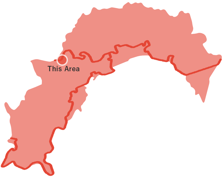
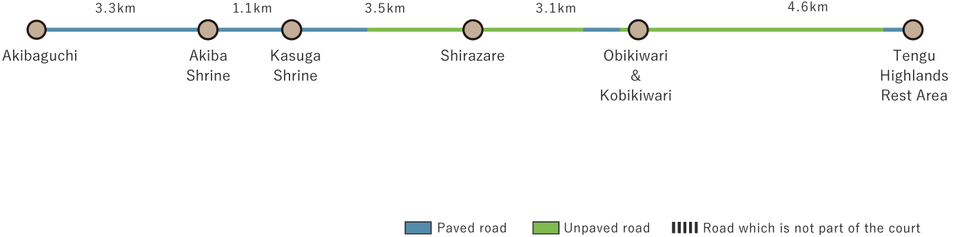
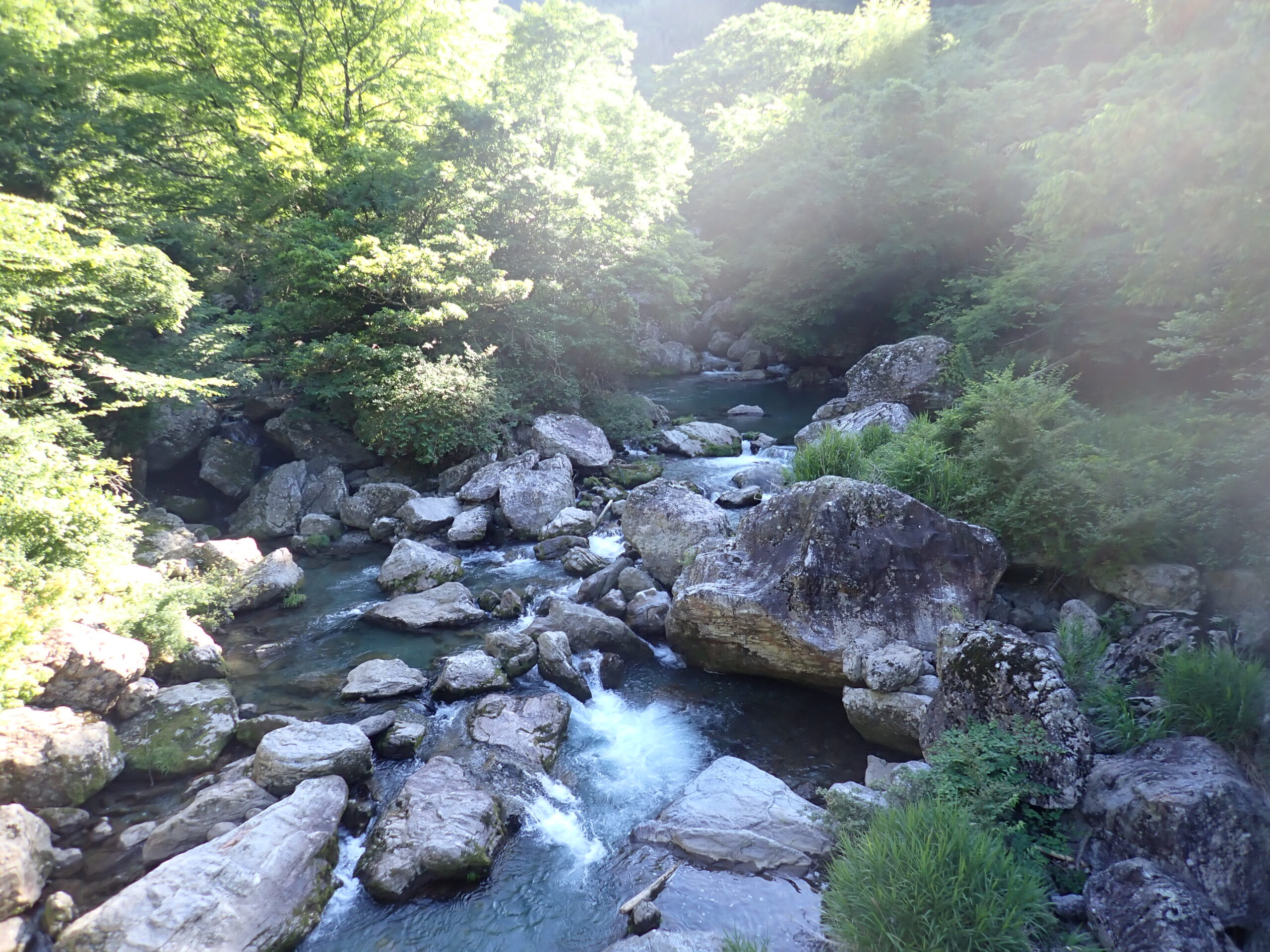
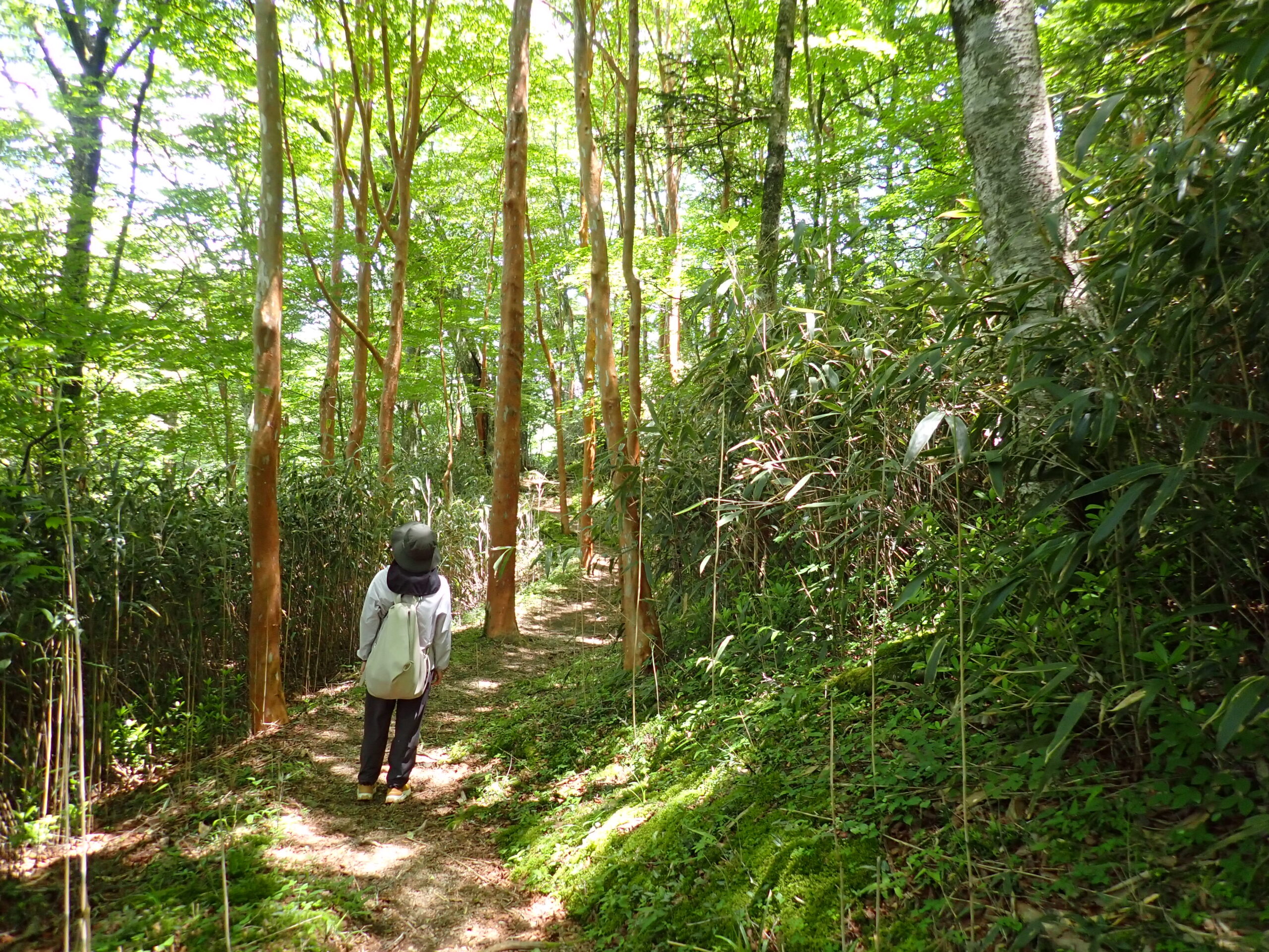
This is the final destination of the Shikoku Nature Trail in Kochi Prefecture. The 15.6 km mountainous route begins at Akibaguchi and extends from Niyodogawa Town to Tsuno Town, ending at the Tengu Highlands. From Shirazare onward, the trail passes through dense forests, where hikers can enjoy the lush greenery and the gentle murmur of the river. Summers here are cool, but in winter, snowfall is common, so be sure to prepare for the cold. As you continue, you will come across Obikiwari and Kobikiwari, dramatic fissures in the earth. When sunlight filters through, the scene takes on a mystical quality. These formations were designated as National Natural Monuments in 1986. Past the forest, the vast grasslands of the Tengu Highlands unfold, dotted with limestone outcrops—a rare karst landscape in Japan.
Trail to the Tengu Highlands(15.6km)


※下記表はスクロールしてご覧ください。
 Spots to photograph
If you wish to receive a certificate, please take a photo that includes yourself at the designated photo point for each course.
Nearby sightseeing spots
-
1
 Iwayagawa Gorge
Home to a tributary of the Niyodo River, Iwayagawa Gorge is a breathtaking landscape of unique rock formations, massive boulders, and clear streams that flow between these rocks to make scenic waterfalls and pools. Old pine trees and autumn foliage add to its charm. With well-maintained parking and walking trails, it is an easily accessible spot to experience nature's beauty.
-
2
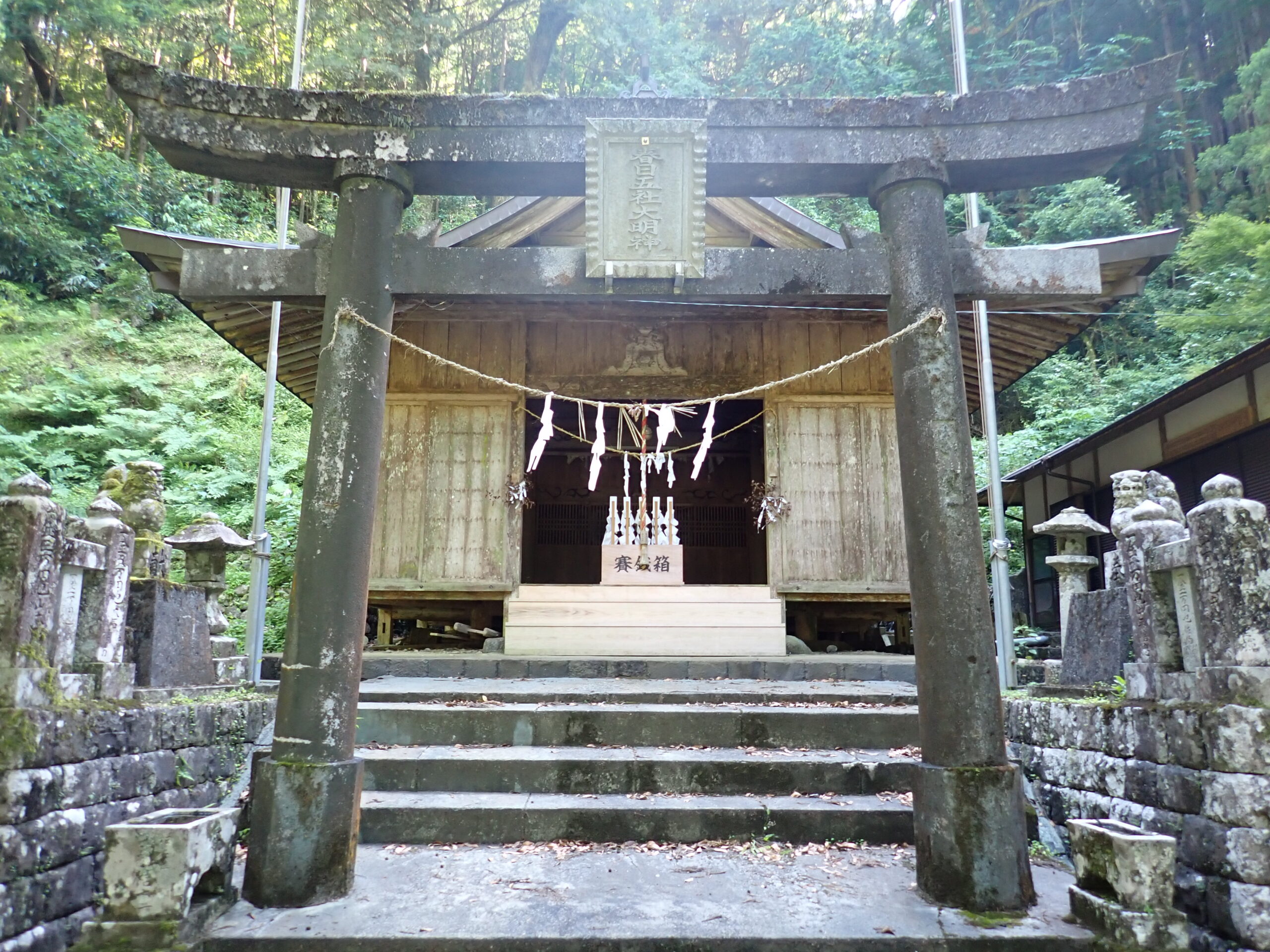
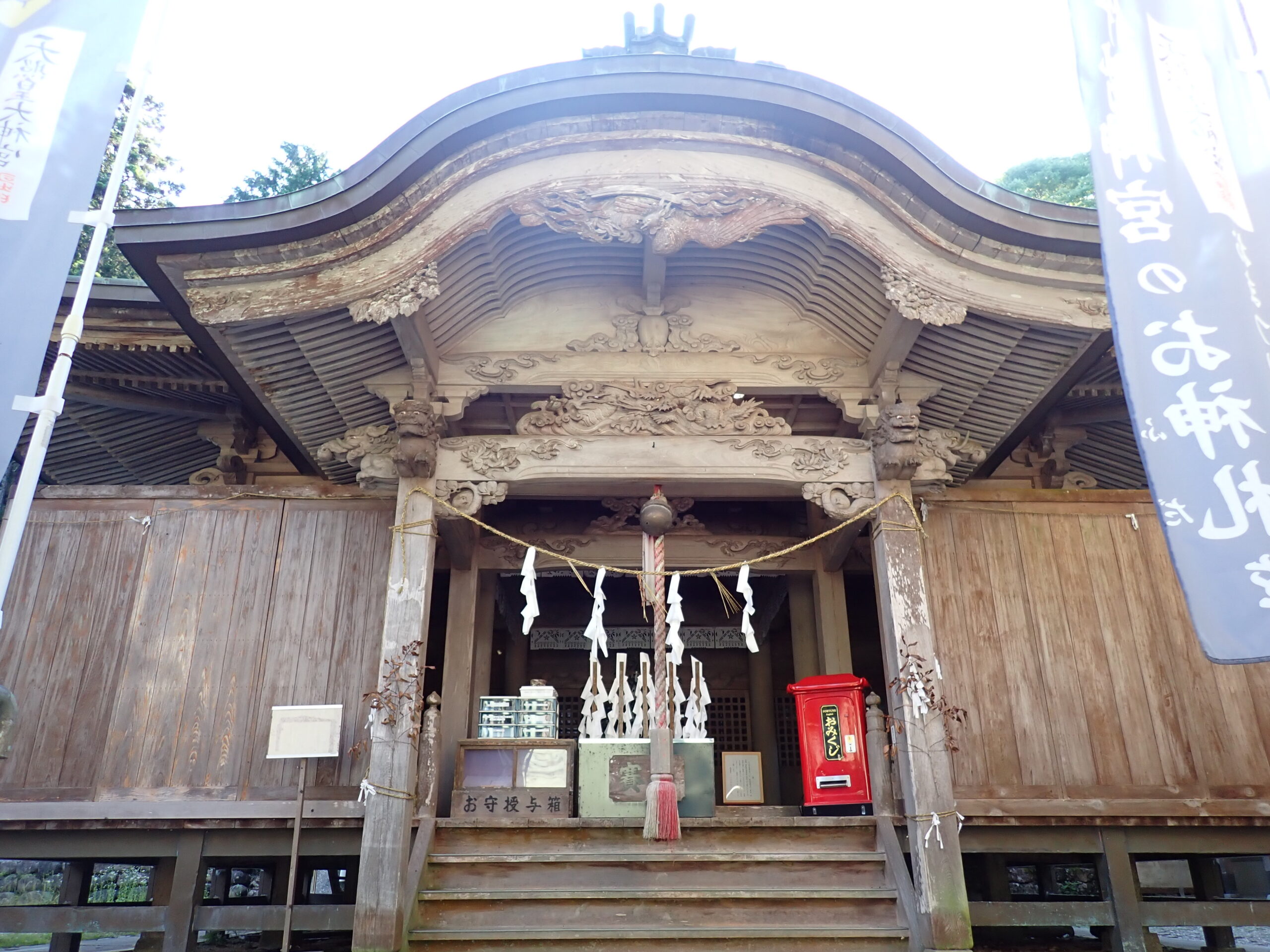 Akiba Shrine
Akiba Shrine is dedicated to Hobusunano-Mikoto, a deity believed to protect against fires. Its origins trace back to a defeated Heike warrior, Sato Kiyoiwa, who brought the shrine's deity from Mt. Akiha in Enshu and enshrined it in a cave. Later, the Ichikawa family, gatekeepers of the Hosenji checkpoint, continued the worship. In 1794, the shrine was moved to its current location. Since then, the shrine has hosted the Akiba Festival, an annual ritual procession involving the Iwaya Shrine, the Ichikawa family, Hosenji, and the Nakagoshi family. Held every February 11, the highlight of the festival is the Torige Hineri, where participants throw 7-meter long, 8-kg feathered spears—a thrilling spectacle. The Akiba Festival is one of Tosa's three major festivals and is designated an Intangible Cultural Property of Kochi Prefecture.
-
3
 Kasuga Shrine
Kasuga Shrine was originally established during the Engi era (901-923) as a private place of worship after being enshrined from Kasuga Shrine in Mt. Kasuga, Yamato Province (present-day Nara Prefecture). As the number of worshippers grew, a shrine building was constructed in 1616, enshrining the Five Great Deities of Kasuga. The current shrine building was constructed in 1811, and in 1870, it was designated as a Gosha (village shrine). In front of Kasuga Shrine is Kasuga Park, which was completed in 1953 as a relaxation space for the residents of the Besshi-kami district. Visitors can enjoy its seasonal scenery throughout the year.
-
4
 Himeshara Forest
The Himeshara tree, a member of the camellia family, resembles Sarusuberi (crape myrtle). Locally known as Akata, it blooms with white flowers during the rainy season. The path lined with Himeshara trees provides seasonal beauty all year round.
-
5
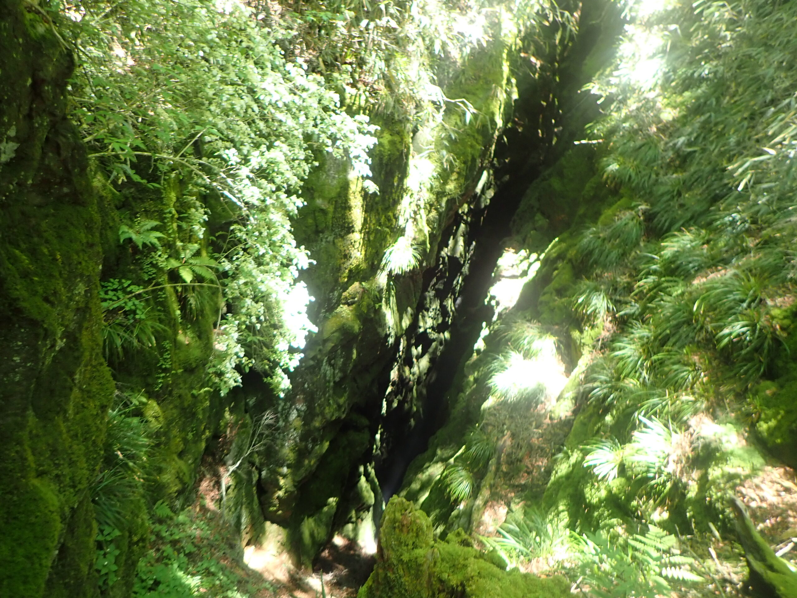 Obikiwari & Kobikiwari
Located at an elevation of 1,100 meters between Tengu Forest and Mt. Torigata, these two fissures cut through red and reddish-brown chert (silica) from the Paleozoic Permian period and belong to the Shirakidani Group. The Obikiwari fissure is 80 meters long, 3-8 meters wide, and 30 meters deep, while Kobikiwari is 100 meters long, 1.5-5 meters wide, and 20 meters deep. The two fissures run east to west, 30 meters apart. They were designated as a National Natural Monument in 1986.
-
6
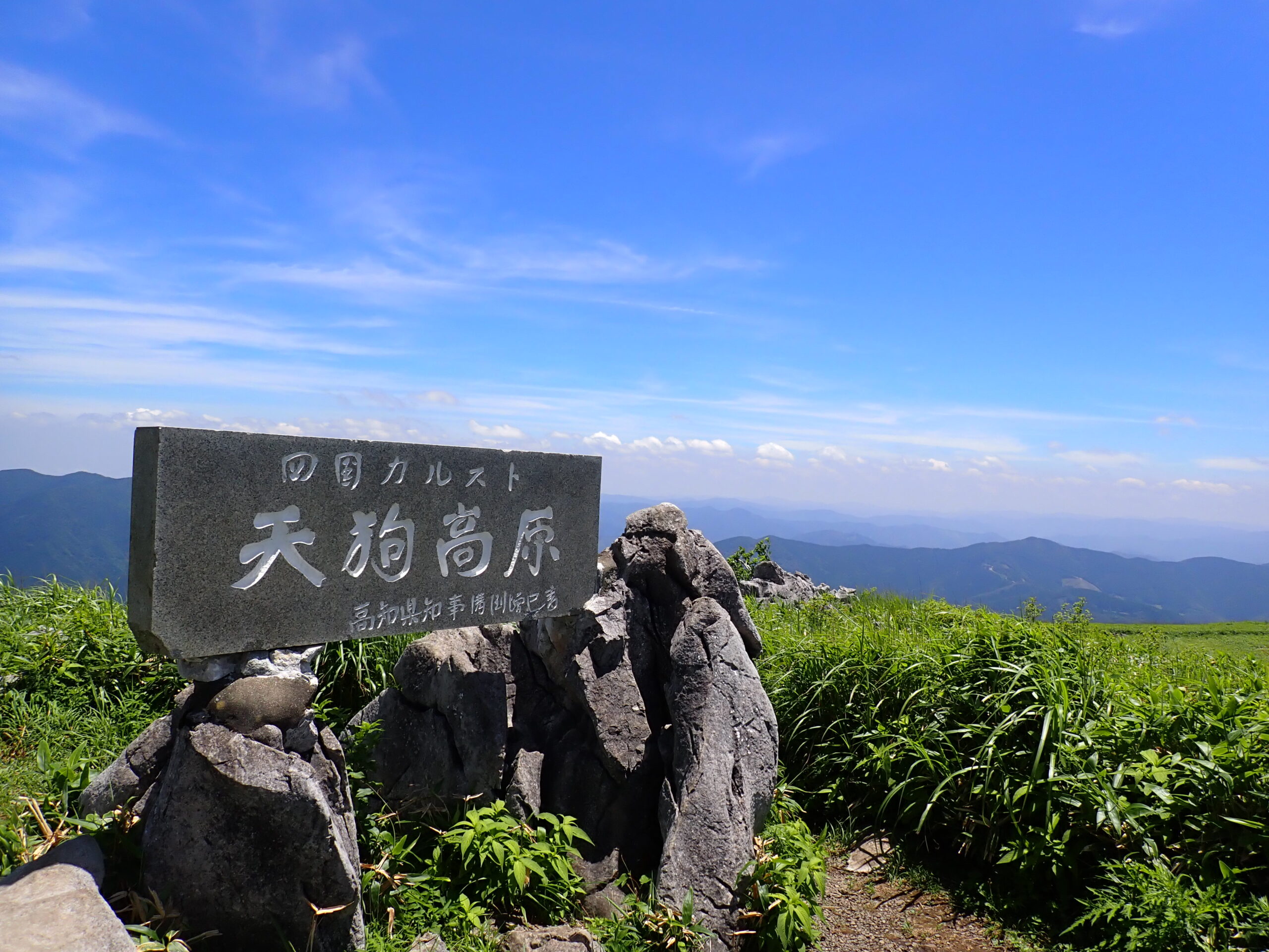 Tengu Highlands
The Tengu Highlands is a gently rolling highland located at the northern tip of Tsuno Town, with its highest point at Tengu Forest, at an elevation of 1,485 meters. The vast grasslands are dotted with limestone formations, making it one of Japan's rare karst landscapes. It is also counted among Japan's three major karst formations. The area is home to a rich variety of alpine plants, including Himeyuri (morning star lily) and Yamashakunage (Rhododendron degronianum), making it a beloved destination for plant enthusiasts. At Hoshifuru Village TENGU, visitors can stay at the accommodation and enjoy visiting the planetarium, while the Karst Terrace across from it offers nature learning experiences. On clear days, visitors can enjoy views of the Pacific Ocean and may even catch a glimpse of Cape Muroto and Cape Ashizuri.

