Scent of Salt Spray on Yasakayahama Beach
Scent of Salt Spray on Yasakayahama Beach
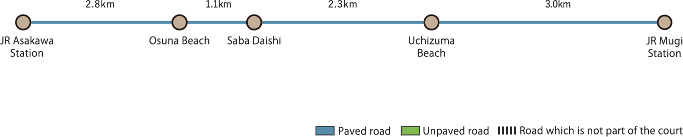
Go south from JR Mugi Station on National Route 55. After going through a short tunnel, take a left to enter an old national highway. It’s quiet here as there is rarely any traffic. When you get to the end of this road, you will arrive at Uchizuma Beach, a popular spot for surfers on days when the waves are high. Follow the national route along the coast and Oshima Island, Tsushima Island, and Tebajima Island will appear in the horizon. Cross Kaiyo Town and exit the tunnel, and you will finally see Saba Daishi, alternatively known as Yasakadera Temple. Despite being an annex temple building, the temple attracts many visitors all year round. Proceed further south while enjoying the sea breeze and you will reach Osuna Beach, one of the top 100 beaches in Japan according to the Ministry of the Environment. The blissful scents of the sand and the sea are even stronger here and Ajirosaki can be seen beyond the tranquil Asakawa Bay. At Iseda River, exit the national highway and head towards Asakawa Port. Bid farewell to the ocean at the Asakawa Port, and once you cross the middle of Asakawa Town, you will reach your destination, JR Asakawa Station.
Scent of Salt Spray on Yasakayahama Beach(9.2km)


※下記表はスクロールしてご覧ください。
 Spots to photograph
If you wish to receive a certificate, please take a photo that includes yourself at the designated photo point for each course.
Nearby sightseeing spots
-
1
 Muroto Anan Kaigan Quasi-National Park
A seaside park that spans Tokushima prefecture and Kochi prefecture. Its coastal area extends for about 200km from Awashima Beach in Anan Town to Hanezaki in the Muroto Cape. Tachibana Bay has a sawtooth-shaped coastline with countless scattered and land-tied islands as well as caves, making for an captivating view. The fault coast stretches along a straight line from Cape Kamoda to Yuki, Hiwasa, and Mugi and the Sembakaigai cliff has a height of 240 meters. In addition, Ohama Coast is well known as a spawning site for loggerhead turtles. South of Mugi are Yasakayahama and Mitoko, the landscape changes to a more detailed scenery.
-
2
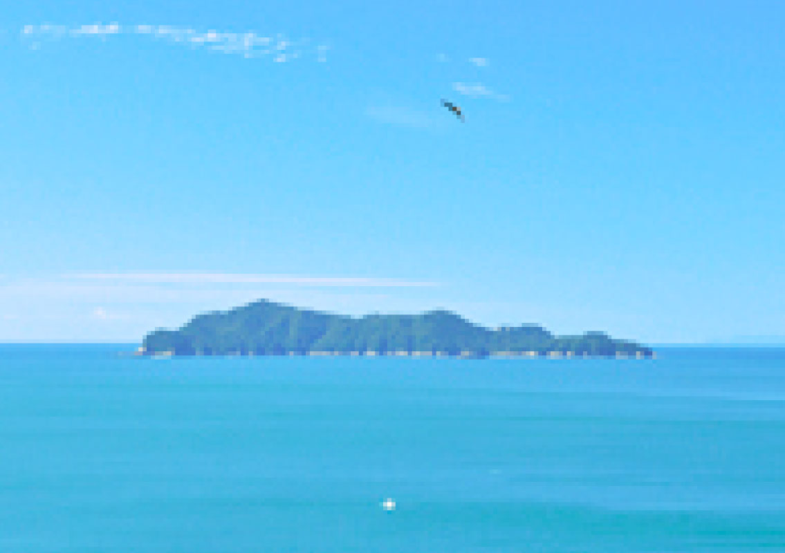 Oshima, Tsujima, and Tebajima Islands
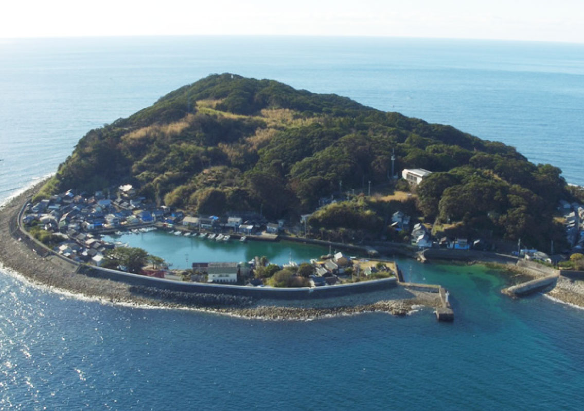
Thanks to the Kuroshio current, these isolated islands off the coast are the warmest places of the prefecture and are home to many subtropical vegetation that cannot be found on the mainland. Oshima Island is a big island extending over a dozen kilometers. The evergreen forest that thrives in environments with ample sunlight provides a wonderful landscape evoking that of a tropical country. Tsushima is home to magnificent natural beech tree forests. The island was designated as a national natural monument precisely for these evergreen broad-leaved forests. Lastly, Tebajima Island is a base for fishing activities and settlements and farms developed here a long time ago. Only the lake in the southern part of the island is left untouched as it is home to the rare Shiratamamo that still grows there today.
-
3
 The Shiratamamo in Tebajima Island
Shiratamamo is a type of small aquatic plant living in the lakes of Tebajima Island. The plant creates characteristic white spheres in its roots, and this is where the name comes from (“shiratama” means white balls in Japanese). Shiratamamo grows in lakes where freshwater and seawater meet with a salt concentration which is half that of seawater. The plant is believed to have appeared about 100 million years ago during the Cretaceous period in places where seawater transitions to freshwater. Its survival to this day in the process of evolution is a rare occurrence and for that reason, it’s known as a living plant fossil. Besides Tebajima and Minami in Mugi Town, Shiratamamo is native only to Mauritius Island in the Indian Ocean, New Caledonia in the Southern Pacific, and the Libyan Sea in Africa. Acknowledging the island’s significant importance as a natural habitat for Shiratamamo, the government of Japan designated the lake of Tebajima Island as a national natural monument. Visitors can see Shiratamamo at the aquarium in front of the Tebajima Fishing Village Center.
-
4
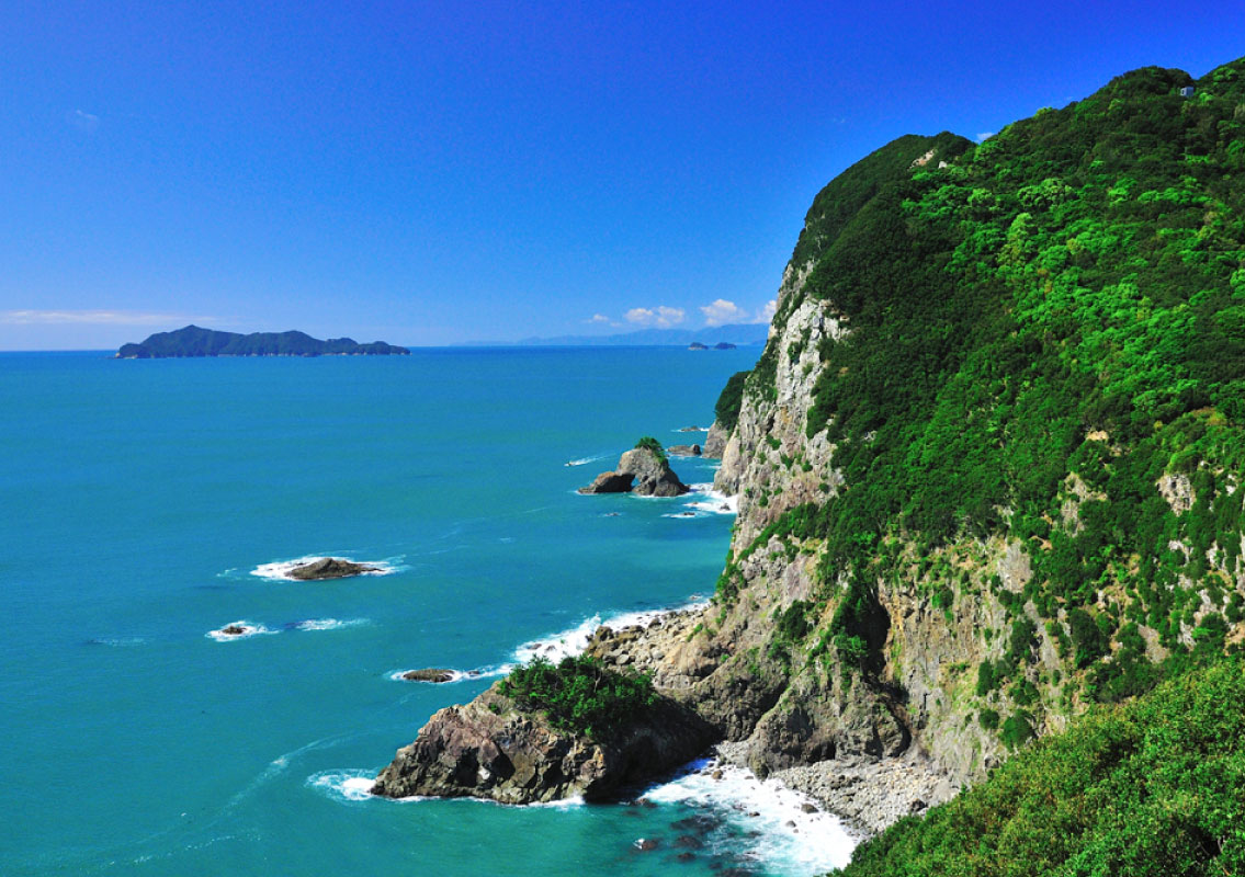
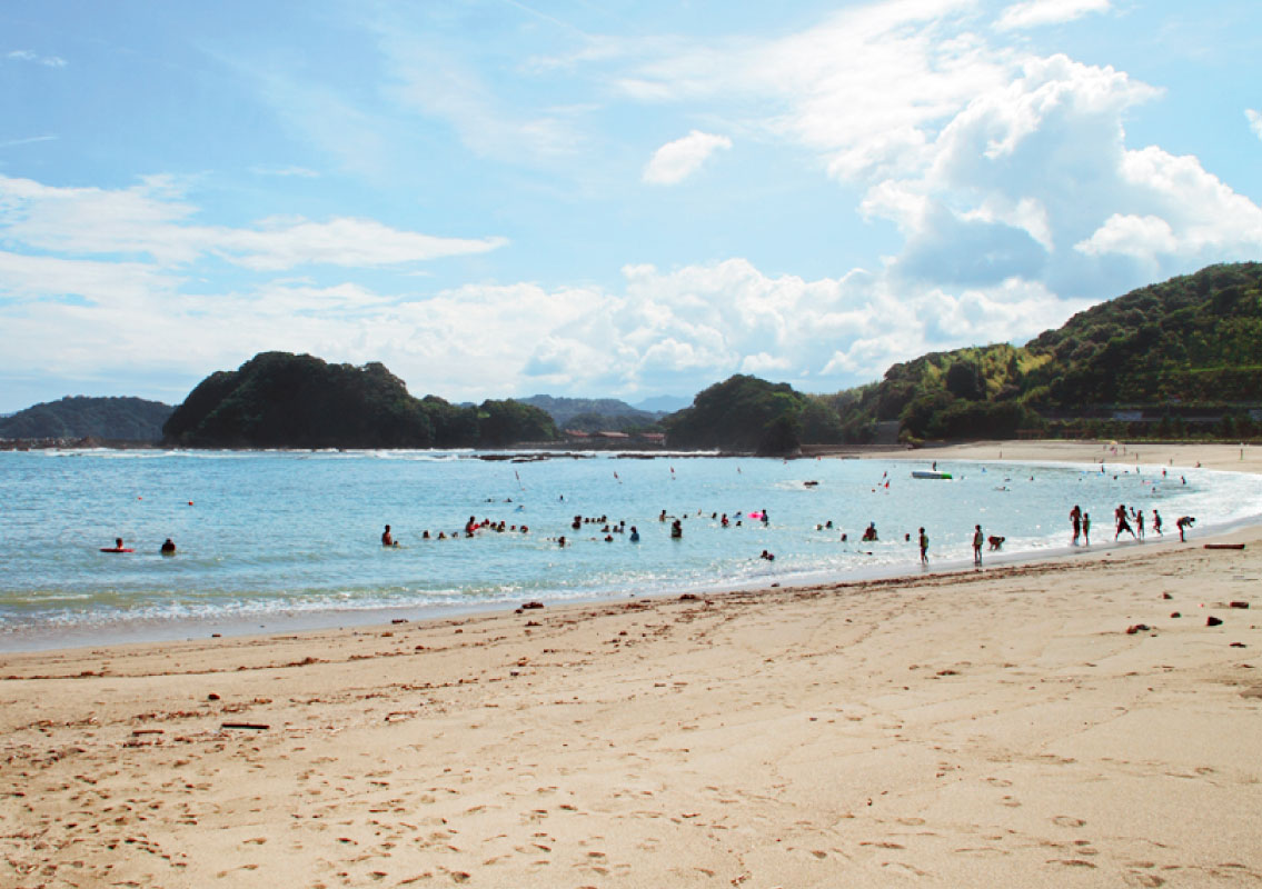 Yasakayahama Coast
An 8-kilometer long coast of alternating capes and coves starting from Mugi Town and ending at Asakawa Port, with a beautiful landscape from the dramatic contrast between the deep blue ocean and the green pine trees. From here, you can admire the magnificent view of the Pacific Ocean, with Oshima, Tsushima and Tebajima Islands in the foreground.
-
5
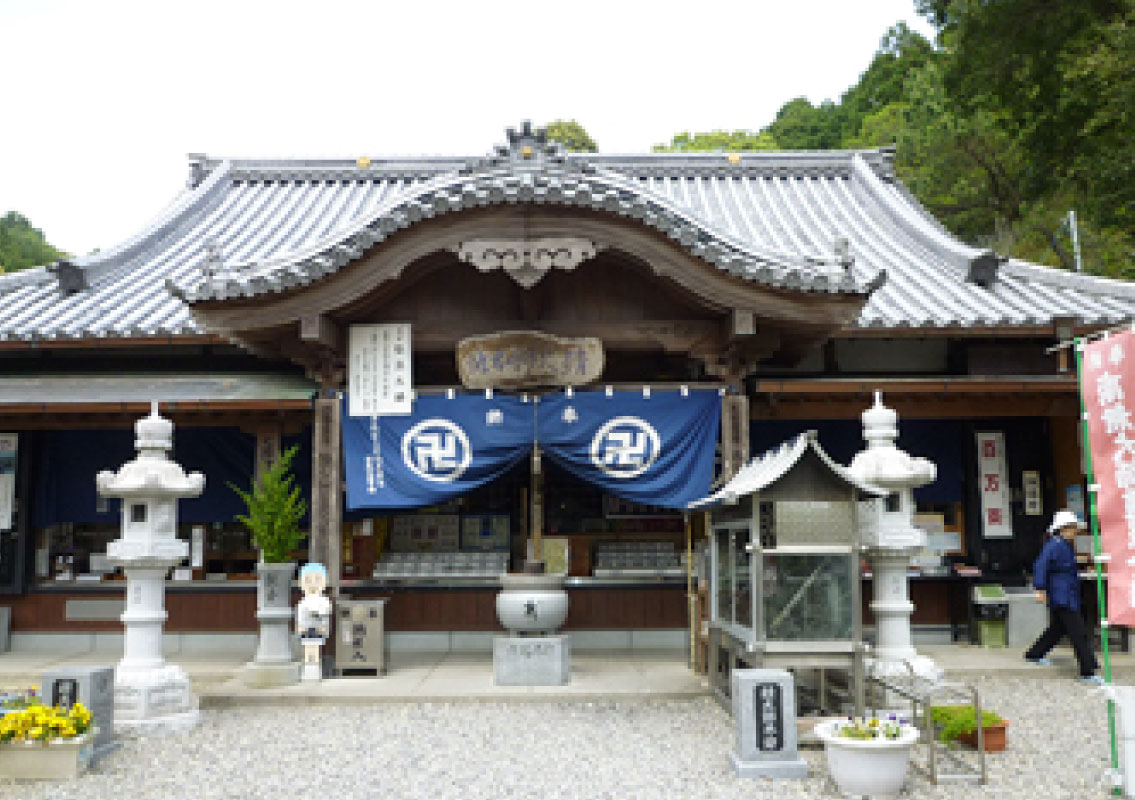 Saba Daishi (Yasaka-dera Temple)
According to history, this temple used to be called Gyokian, taking its name from its founder, Buddhist priest Gyoki Bosatsu. When Master Kobo Daishi (famous Japanese Buddhist monk and scholar) was on his preaching tour in Shikoku, it was here that he met a horseman hanging a mackerel. Kobo Daishi begged for the mackerel to be released back into the ocean but the horseman walked to the pass, cursing. After a while, the horseman’s horse fell over at the pass, suffering from a stomachache. The horseman understood it as a punishment for his deed. He turned back and repented and handed the mackerel to Kobo Daishi and immediately, the horse regained its spirits. The master healed and released the mackerel, who revived and swam off into the ocean. The horseman saw what happened and was startled with surprise. He decided to build a thatched hut on the land and performed good deeds to help others. Time passed and this thatched hut became none other than Saba (mackerel in Japanese) Daishi. The temple is located in Sabase, Yasakayahama, a place considered to be the most dangerous spot in Awa province. It was also a resting spot for pilgrims as it was situated between the 23rd temple (Yakuoji Temple in Minami Town) and the 24th temple (Hotsumisakiji in Muroto City) on the long and treacherous Shikoku pilgrimage route of 88 temples.

