Mt. Takanawa Bird Watching Road
Mt. Takanawa Bird Watching Road
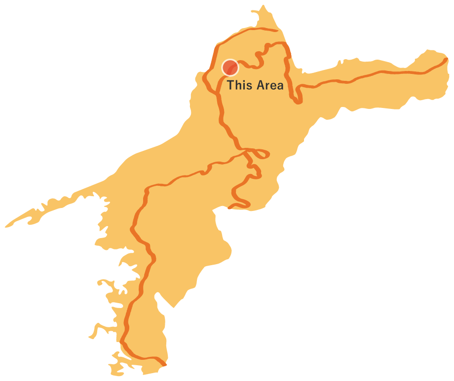
The route begins in front of Gomyou Elementary School in Sugezawa, Matsuyama City. Stretching 10.2 kilometers to Takanawa Temple, it crosses two mountain passes: Koujiga Pass and Ishiga Pass. Many wild birds are drawn to the ancient beech forests of Mt. Takanawa, gathering here throughout all four seasons. Enjoy a pleasant walk as you listen to the birdsong around you.
Mt. Takanawa Bird Watching Road(10.2km)


※下記表はスクロールしてご覧ください。
 Spots to photograph
If you wish to receive a certificate, please take a photo that includes yourself at the designated photo point for each course.
Nearby sightseeing spots
-
1
 Starting point: Gomyou Elementary School
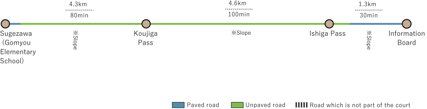
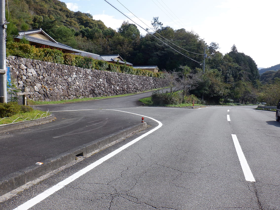
The route starts in front of Gomyou Elementary School, situated along the prefectural road in Sugezawa, Matsuyama City. The mountain road climbs up from the prefectural road.
-
2
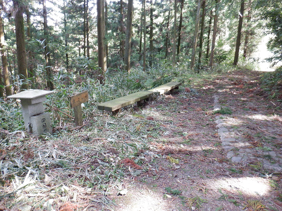 Koujiga Pass Rest Area
This pass, at 525 meters above sea level, marks the border between old Matsuyama City and old Houjou City. Before 1955, the area around the pass was part of Kouno Village in Kazahaya District, at the heart of old Houjou City. Kazahaya District was ruled by the Kouno clan from the late Heian period until Toyotomi Hideyoshi's Shikoku conquest. The people there have deep ties to old Houjou City. In fact, in the era before cars, it was often faster to travel toward Houjou from here than to the centers of the other cities. At this pass, benches sit beneath sunlight filtering through trees, an inviting spot for a quick rest before trekking up the mountain road to Mt. Takanawa.
-
3
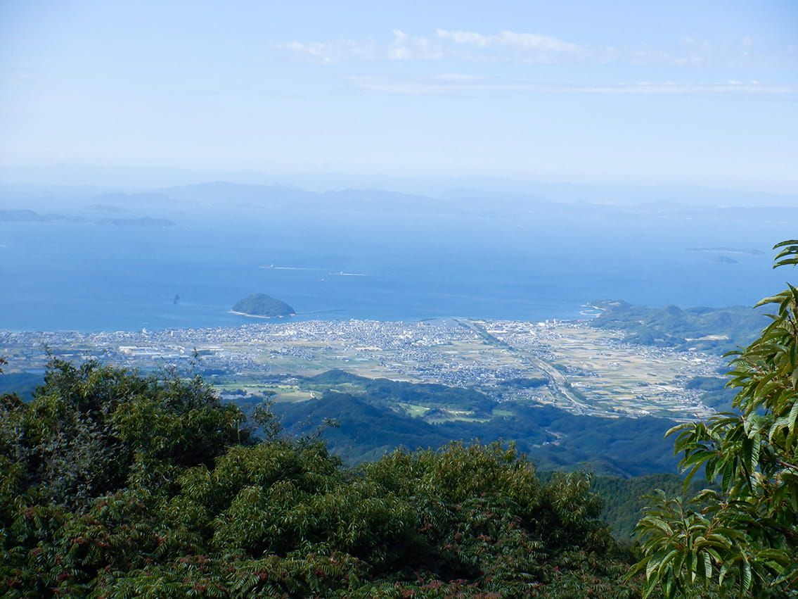 Mt. Ootsuki Observation Deck
On Mt. Ootsuki, an observation deck overlooks the old Houjou City and the Seto Inland Sea. From here, you can see the Tateiwa River winding through the city center and Kashima Island out at sea. On clear days, Nakajima Island in Matsuyama City is also visible. The Seto Inland Sea shimmers emerald green. Islands of various sizes float here, creating a striking contrast with the sea's color. If bridges ever connect these islands, entirely new routes may become possible.
-
4
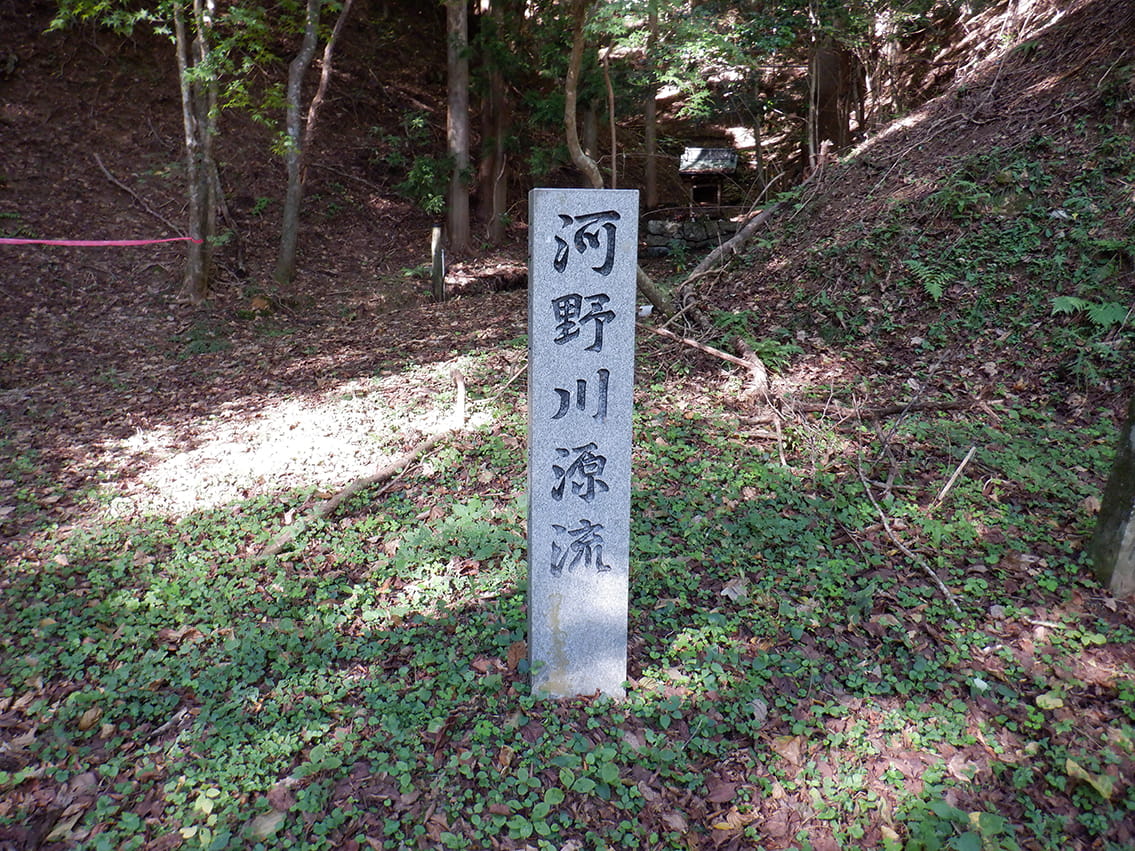 Kouno River Source Monument
The Kouno River's source monument stands near Mt. Takanawa. This marks the source of the Kouno River, which flows through the Houjou area. This small, clear stream gently flows onward to the Seto Inland Sea.
-
5
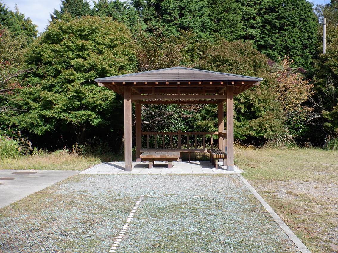 Takanawa Temple Rest Area
A gazebo sits in a sunny spot within the quiet forest. With the trail ending soon, the gazebo is a perfect place to pause and rest.
-
6
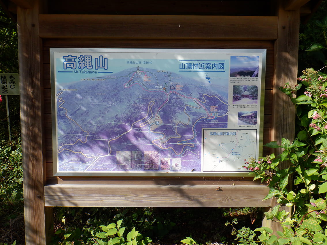 Mt. Takanawa Information Board
Mt. Takanawa crowns Okudogo-Tamagawa Prefectural Natural Park at an elevation of 986 meters. Old beech groves near the summit create a very pleasant environment for local flora and fauna, supporting a rich and abundant ecosystem. This mountain range is a treasure trove of biodiversity, home to over 600 species of plants, mammals, and insects. It is also a premier bird-watching site, where more than 70 bird species can be observed each year. The Shikoku Trail reaches the summit of Mt. Takanawa, but you can view the summit area's information board at the Takanawa Temple Rest Area.
-
7
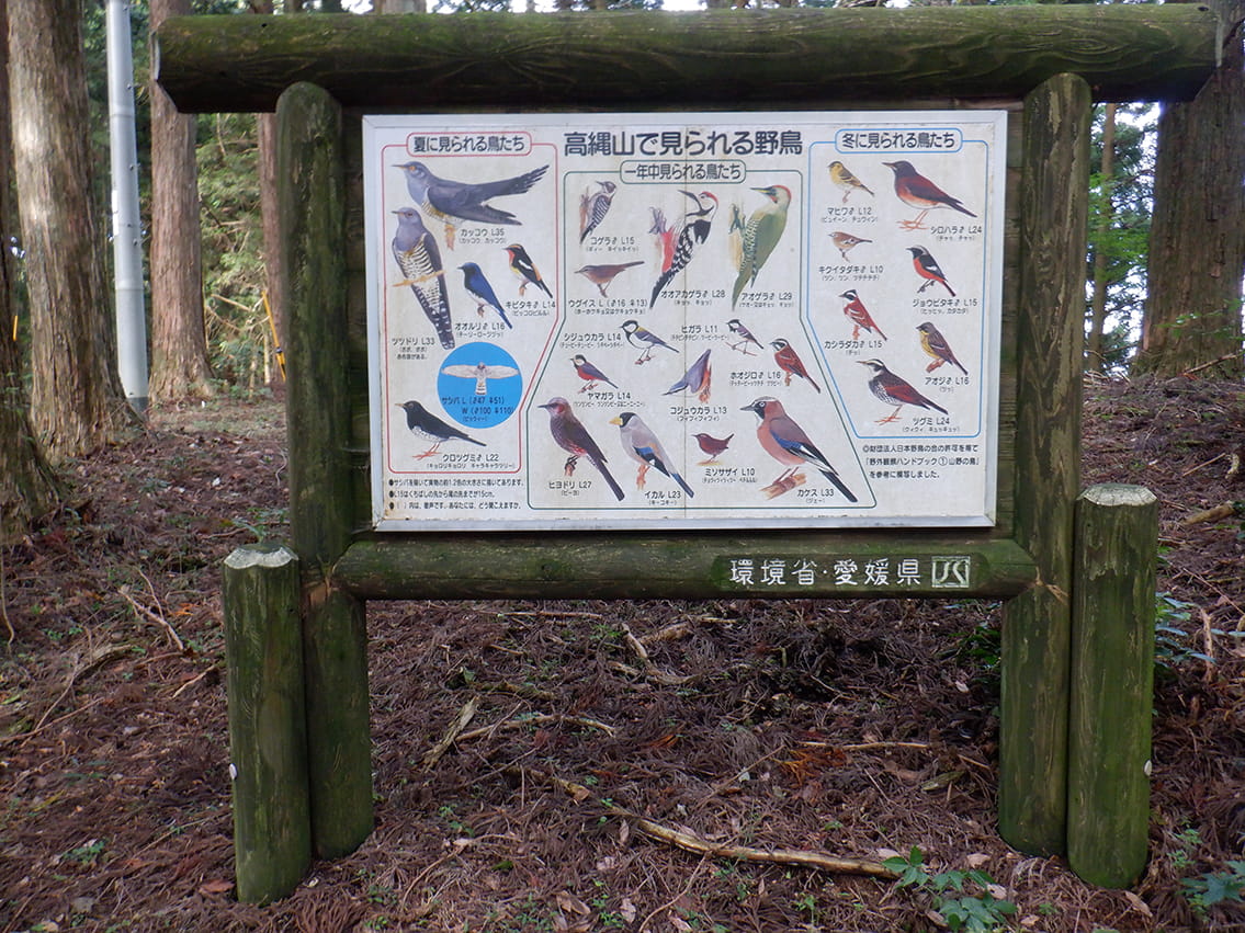 Endpoint: Information Board
At the endpoint, an information board introduces the wild birds of Mt. Takanawa. The next trail begins at Takanawa Temple, about 100 meters back along the route you just traveled.

