Yamabiko Path
Yamabiko Path
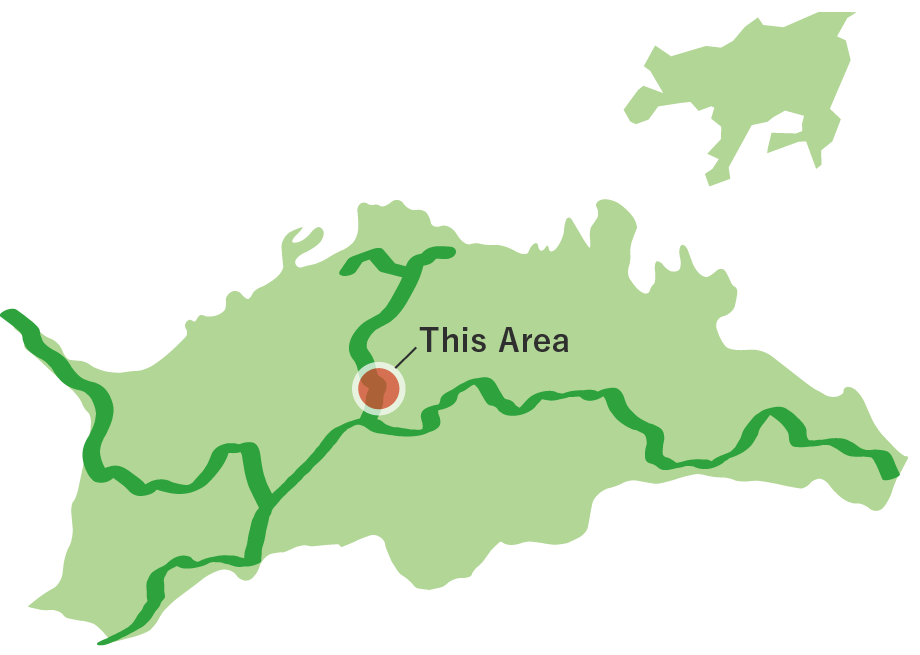
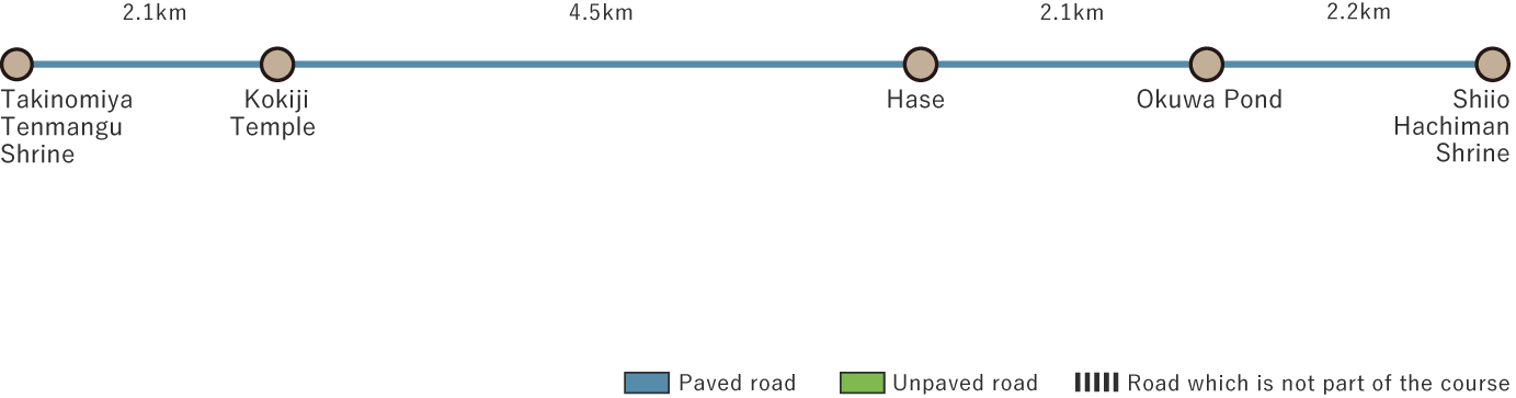
The Yamabiko Path stretches 10.9 km through the scenic mountain village countryside along the Ayagawa River, Kagawa's longest river. You can begin at Takinomiya Tenmangu Shrine, which has a historical connection to the scholar, Sugawara no Michizane, then pass through the peaceful Kokiji Temple and end at Shiio Hachiman Shrine, enjoying the temples and shrines along the way. Winding through landscapes shaped by granite geology, this route connects reservoirs and temples and shrines, offering a charming walk where local history and nature harmoniously come together.
Yamabiko Path(10.9km)


※下記表はスクロールしてご覧ください。
 Spots to photograph
If you wish to receive a certificate, please take a photo that includes yourself at the designated photo point for each course.
Nearby sightseeing spots
-
1
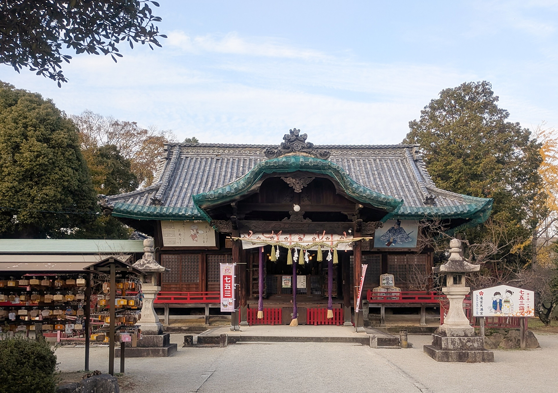 Takinomiya Tenmangu Shrine
This historic shrine stands on the site where Sugawara no Michizane, revered as the god of learning, once served as governor of Sanuki. During the great drought of the year 888, rain fell in response to Michizane's prayers, and the delighted people danced. This is considered the origin of the "Takinomiya Nenbutsu Odori" dance, which is designated as a UNESCO Intangible Cultural Heritage.
Even today, the dance is performed annually on August 25. In April, the "Usokae Shinto Ritual" is held, in which participants exchange carved wooden birds to ward off misfortune. As the prefecture's foremost sacred site for learning, the shrine attracts many visitors who come to pray for academic success and to ward off misfortune. -
2
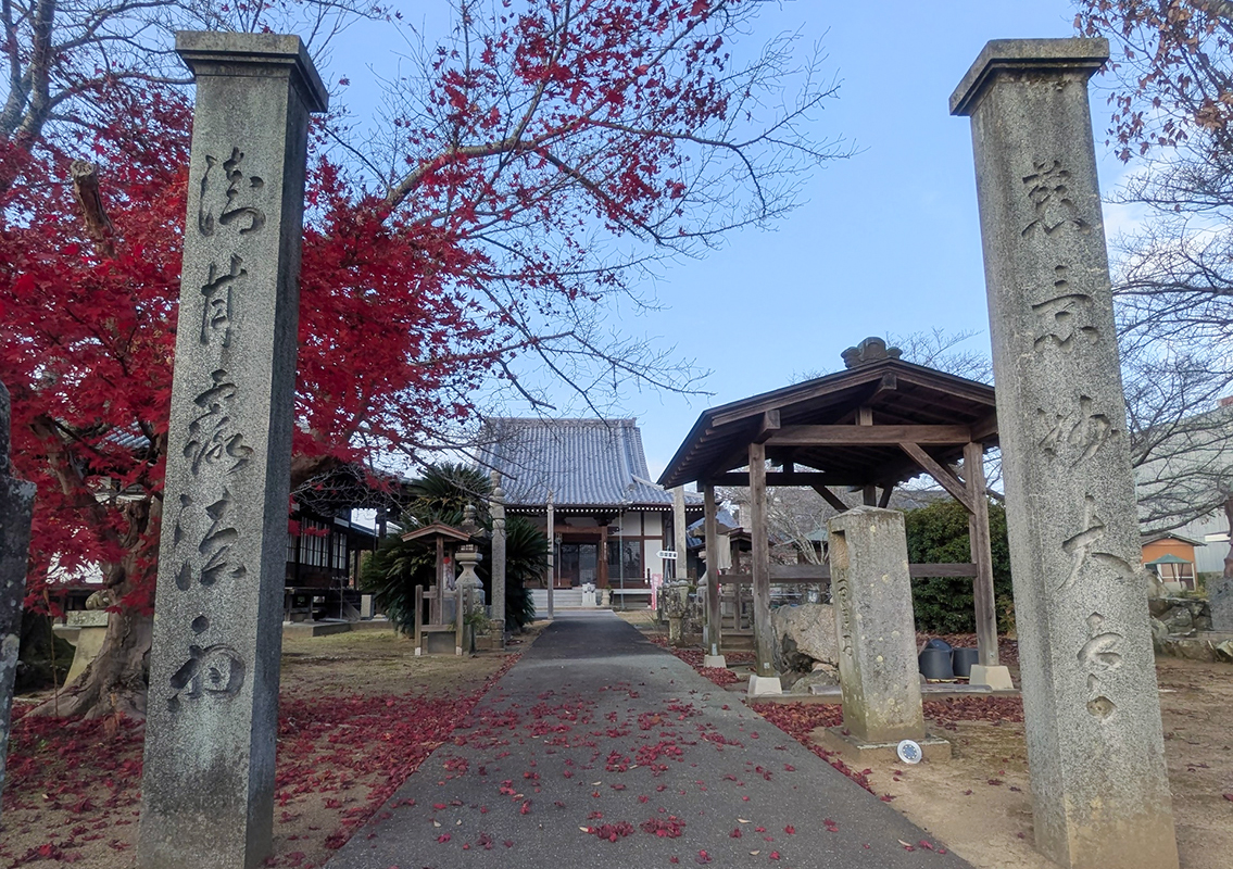 Kokiji Temple
Kokiji Temple, located next to Kagawa Prefectural Agricultural Management High School, is a historic temple said to have been founded by Gyoki and where Kukai carried on the Buddha's teachings. On the north side of the temple grounds, across the road, is a miniature 88 Sacred Sites pilgrimage route, where rows of Jizo statues stand along Shikoku 88- Temple Pilgrimage a well-maintained path.
-
3
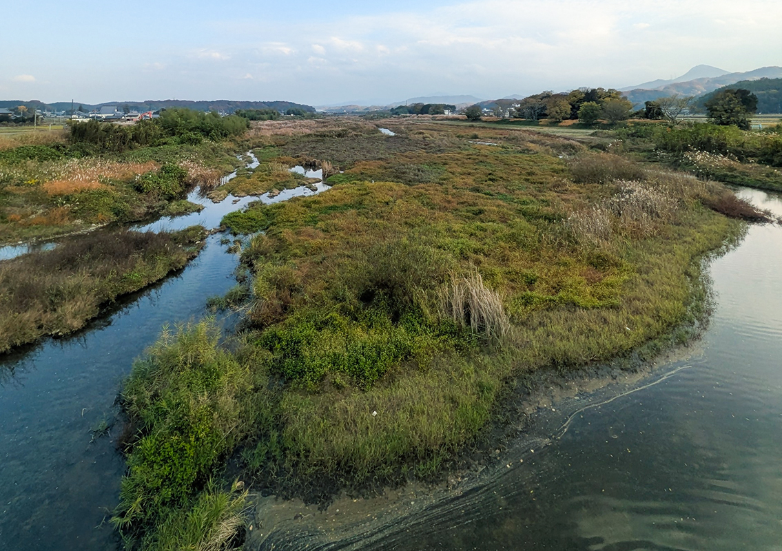 The Ayagawa River
The Ayagawa River, the longest Class B river in Kagawa Prefecture, originates in Shionoe Town, Takamatsu City, and flows from the west to northwest into the Seto Inland Sea.
Much of the river basin is composed of granite, and its midstream features—such as Nagara Pond and the vast Fuchu Lake, which spans Sakaide City—are known for their scenic waterside landscapes. As the longest river in the prefecture, it has long supported the agricultural life of the region. -
4
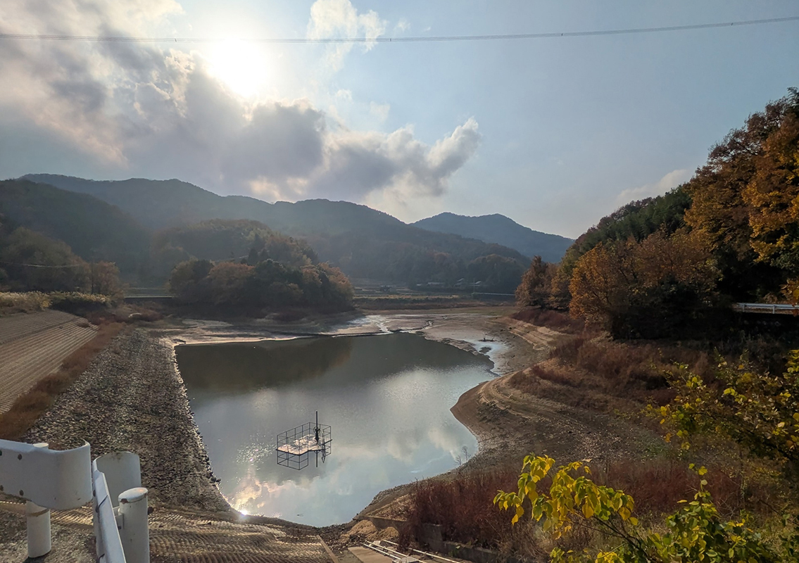 Okuwa Pond
Okuwa Pond, located in Nishibun, Ayagawa Town, is a large reservoir with a capacity of 162,000 cubic meters.
This area, known as Sakaiba, is said to have long been bustling with people making pilgrimages to Mount Tsurugi and Mount Oyama. -
5
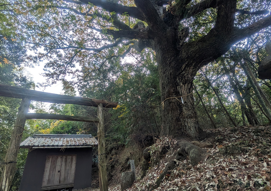 Kagawa Preserved Tree: Chinese Cork Oak at Daishogun Shrine
You can reach Daishogun Shrine by climbing the steep stairs along the sharply curved road that runs alongside the community hall.
The Chinese cork oak tree standing to the right of the torii gate within the compact shrine grounds is a giant tree reaching a height of 20 meters with a breast-height trunk circumference of 3.4 meters. In addition, lichens cling to the bark with its well-developed cork layer, while the three-way branching trunk spreads its branches majestically over an area 25 meters east-west and 21 meters north-south. -
6
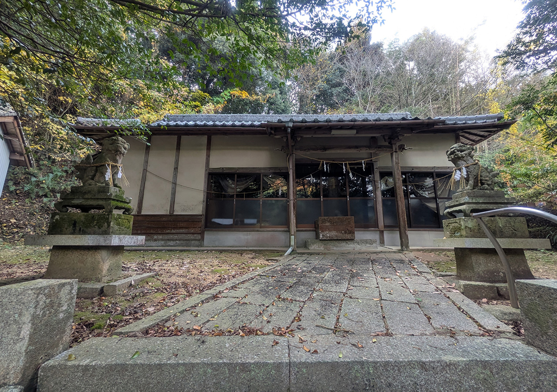 Shiino Hachiman Shrine
Shiio Hachiman Shrine in Ayagawa Town is known for its mystical shrine forest. As its name suggests, there are many chinquapin trees, and because it is considered one of the largest Japanese chinquapin (Tsuburajii) pure forests in the prefecture, it has been designated as a Natural Monument. It is also a hidden local landmark that draws faith from the local community and serves as the starting point of the Shikoku route.

